Fang County
房县 | |
|---|---|
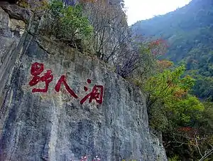 Inscription in cliff face next to the entrance of the "Yeren Cave". The inscription reads "Ye Ren Dong" ("Wild Man Cave"). | |
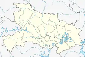 Fangxian Location in Hubei | |
| Coordinates: 32°06′N 110°36′E / 32.100°N 110.600°E | |
| Country | People's Republic of China |
| Province | Hubei |
| Prefecture-level city | Shiyan |
| Area | |
| • Total | 5,110 km2 (1,970 sq mi) |
| Population (2010)[1] | |
| • Total | 390,991 |
| • Density | 77/km2 (200/sq mi) |
| Time zone | UTC+8 (China Standard) |
Fang County or Fangxian (simplified Chinese: 房县; traditional Chinese: 房縣; pinyin: Fáng Xiàn) is a county of northwestern Hubei province, People's Republic of China. It is under the administration of Shiyan City.
The county spans an area of 5,110 square kilometres (1,970 sq mi),[2] and has a population of 390,991 as of 2010.[1]
History
During the Spring and Autumn period, the region was known as Fangzhu (Chinese: 防渚; pinyin: Fángzhǔ).[1]
During the Warring States period, the area belonged to the State of Chu.[1]
The area was incorporated as Fangling County (simplified Chinese: 房陵县; traditional Chinese: 房陵縣; pinyin: Fánglíng Xiàn) during the Qin dynasty, where it belonged to the Hanzhong Commandery.[1]
In 636 CE, the area of present-day Fang County was organized as Fang Prefecture.[1]
In 1277, Fang Prefecture was changed to Fang County, which it has remained since.[1] It was placed under the jurisdiction of Xiangyang Fu.[1]
In 1476, Xiangyang Fu was changed to Yunyang Fu.[1]
Republic of China
Upon the establishment of the Republic of China, the area was placed under the jurisdiction of Xiangyang Circuit.[1]
In 1931, the area was re-organized as the 11th Administrative Inspectorate of Hubei Province.[1] In 1936, it was changed to be under the 8th Administrative Inspectorate of Hubei Province.[1]
People's Republic of China
In 1949, upon the establishment of the People's Republic of China, the area was administered under the Liangyun Prefecture.[1]
The area was moved to the jurisdiction of the Yunyang Prefecture in 1965.[1]
In 1994, the county was moved to the jurisdiction of the newly-formed prefecture-level city of Shiyan.[1]
Geography
The Wudang Mountains run through the northern part of Fang County, and the Daba Mountains run through its southern part.[2]
The lowest part of the county is Jiangjiapo (Chinese: 姜家坡), in Damuchang, which stands 180 metres (590 ft) above sea level.[2] The highest part of the county is Guanjiaya (Chinese: 关家垭), in Shangkan Township, which stands 2,485.6 metres (8,155 ft) above sea level.[2]
Climate
| Climate data for Fangxian (1991–2020 normals, extremes 1981–2010) | |||||||||||||
|---|---|---|---|---|---|---|---|---|---|---|---|---|---|
| Month | Jan | Feb | Mar | Apr | May | Jun | Jul | Aug | Sep | Oct | Nov | Dec | Year |
| Record high °C (°F) | 20.6 (69.1) |
25.6 (78.1) |
33.7 (92.7) |
35.0 (95.0) |
37.9 (100.2) |
38.9 (102.0) |
41.4 (106.5) |
39.3 (102.7) |
40.3 (104.5) |
32.0 (89.6) |
28.9 (84.0) |
20.5 (68.9) |
41.4 (106.5) |
| Mean daily maximum °C (°F) | 8.5 (47.3) |
11.6 (52.9) |
16.9 (62.4) |
23.0 (73.4) |
26.6 (79.9) |
30.0 (86.0) |
32.0 (89.6) |
30.9 (87.6) |
26.4 (79.5) |
21.3 (70.3) |
15.7 (60.3) |
10.2 (50.4) |
21.1 (70.0) |
| Daily mean °C (°F) | 2.4 (36.3) |
5.1 (41.2) |
9.9 (49.8) |
15.7 (60.3) |
19.9 (67.8) |
23.8 (74.8) |
26.1 (79.0) |
25.1 (77.2) |
20.7 (69.3) |
15.3 (59.5) |
9.3 (48.7) |
4.0 (39.2) |
14.8 (58.6) |
| Mean daily minimum °C (°F) | −1.7 (28.9) |
0.6 (33.1) |
4.7 (40.5) |
10.2 (50.4) |
14.9 (58.8) |
19.1 (66.4) |
22.2 (72.0) |
21.3 (70.3) |
17.0 (62.6) |
11.5 (52.7) |
5.2 (41.4) |
0.0 (32.0) |
10.4 (50.8) |
| Record low °C (°F) | −10.1 (13.8) |
−8.8 (16.2) |
−5.5 (22.1) |
−1.0 (30.2) |
2.9 (37.2) |
11.3 (52.3) |
13.7 (56.7) |
13.3 (55.9) |
6.6 (43.9) |
−0.5 (31.1) |
−4.6 (23.7) |
−15.6 (3.9) |
−15.6 (3.9) |
| Average precipitation mm (inches) | 11.4 (0.45) |
15.0 (0.59) |
40.3 (1.59) |
60.5 (2.38) |
105.4 (4.15) |
111.2 (4.38) |
132.5 (5.22) |
137.2 (5.40) |
89.7 (3.53) |
72.1 (2.84) |
31.0 (1.22) |
11.6 (0.46) |
817.9 (32.21) |
| Average precipitation days (≥ 0.1 mm) | 6.1 | 6.9 | 9.3 | 10.2 | 12.8 | 12.2 | 13.9 | 12.3 | 11.5 | 11.2 | 8.3 | 6.3 | 121 |
| Average snowy days | 5.6 | 3.9 | 1.8 | 0 | 0 | 0 | 0 | 0 | 0 | 0 | 1.1 | 3.3 | 15.7 |
| Average relative humidity (%) | 71 | 69 | 68 | 71 | 74 | 76 | 80 | 81 | 80 | 80 | 78 | 73 | 75 |
| Mean monthly sunshine hours | 111.4 | 109.3 | 145.7 | 164.7 | 175.3 | 173.3 | 188.4 | 177.7 | 129.5 | 117.1 | 112.9 | 116.8 | 1,722.1 |
| Percent possible sunshine | 35 | 35 | 39 | 42 | 41 | 41 | 44 | 44 | 35 | 34 | 36 | 37 | 39 |
| Source: China Meteorological Administration[3][4] | |||||||||||||
Administrative divisions
Fang County administers 12 towns and 8 townships.[5][6]
| Name | Hanzi | Pinyin | Division type | Population (2010)[1] |
|---|---|---|---|---|
| Chengguan | 城关镇 | Chéngguān Zhèn | Town | 89,898 |
| Jundian | 军店镇 | Jūndiàn Zhèn | Town | 32,346 |
| Hualongyan | 化龙堰镇 | Huàlóngyàn Zhèn | Town | 20,163 |
| Tucheng | 土城镇 | Tǔchéng Zhèn | Town | 16,404 |
| Damuchang | 大木厂镇 | Dàmùchǎng Zhèn | Town | 26,828 |
| Qingfeng | 青峰镇 | Qīngfēng Zhèn | Town | 27,231 |
| Mengusi | 门古寺镇 | Méngǔsì Zhèn | Town | 26,488 |
| Baihe | 白鹤镇 (房县) | Báihè Zhèn | Town | 28,435 |
| Yerengu | 野人谷镇 | Yěréngǔ Zhèn | Town | 9,638 |
| Hongta | 红塔镇 | Hóngtǎ Zhèn | Town | 31,367 |
| Yaohuai | 窑淮镇 | Yáohuái Zhèn | Town | 10,763 |
| Yinjifu | 尹吉甫镇 | Yǐnjífǔ Zhèn | Town | 7,261 |
| Yaoping Township | 姚坪乡 | Yáopíng Xiāng | Township | 13,008 |
| Shahe Township | 沙河乡 | Shāhé Xiāng | Township | 7,197 |
| Wanyuhe Township | 万峪河乡 | Wànyùhé Xiāng | Township | 6,917 |
| Shangkan Township | 上龛乡 | Shàngkān Xiāng | Township | 8,712 |
| Zhongba Township | 中坝乡 | Zhōngbà Xiāng | Township | 7,130 |
| Jiudao Township | 九道乡 | Jiǔdào Xiāng | Township | 8,675 |
| Huilong Township | 回龙乡 | Huílóng Xiāng | Township | 3,022 |
| Wutai Township | 五台乡 | Wǔtái Xiāng | Township | 3,268 |
Former divisions
In March 2012, Langkou Township (Chinese: 榔口乡; pinyin: Lángkǒu Xiāng) was abolished, and merged into the town of Yinjifu.[1]
Economy
Mineral deposits in the county include copper, iron, lead, zinc, phosphorus, sulfur, coal, and gypsum.[2]
A number of large caves in Fang County also serve as tourist attractions.[2]
Transport
National Highway 209 runs through the county.[2]
References
- 1 2 3 4 5 6 7 8 9 10 11 12 13 14 15 16 17 18 房县历史沿革 [Fang County Historical Development]. xzqh.org (in Chinese). 2014-07-22. Archived from the original on 2021-02-04. Retrieved 2021-02-03.
- 1 2 3 4 5 6 7 房县概况地图 [Fang County Overview]. xzqh.org (in Chinese). 2014-07-22. Archived from the original on 2020-06-03. Retrieved 2021-02-03.
- ↑ 中国气象数据网 – WeatherBk Data (in Simplified Chinese). China Meteorological Administration. Retrieved 11 June 2023.
- ↑ 中国气象数据网 (in Simplified Chinese). China Meteorological Administration. Retrieved 28 May 2023.
- 1 2 2020年统计用区划代码(房县) [2020 Statistical Division Codes (Fang County)] (in Chinese). National Bureau of Statistics of China. 2020. Archived from the original on 2021-02-04. Retrieved 2021-02-03.
- ↑ 房县行政区划 [Fang County Administrative Divisions]. 房县政府网 [Fang County Government Web] (in Simplified Chinese). 29 May 2018. Retrieved 13 December 2018.
城关镇{...}军店镇{...}化龙堰镇{...}门古寺镇{...}大木厂镇{...}青峰镇{...}土城镇{...}窑淮镇{...}尹吉甫镇{...}红塔镇{...}白鹤镇{...}野人谷镇{...}沙河乡{...}万峪河乡{...}九道乡{...}上龛乡{...}中坝乡{...}姚坪乡{...}五台乡{...}黑獐沟{...}九口山{...}杨岔山{...}温泉{...}旱粮场{...}毛家山{...}潭家湾{...}西蒿{...}代东河{...}