Yangpyeong-dong | |
|---|---|
| Korean transcription(s) | |
| • Hangul | 양평동 |
| • Hanja | 楊坪洞 |
| • Revised Romanization | Yangpyeong-dong |
| • McCune–Reischauer | Yangp'yong-tong |
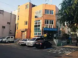 Yangpyeong 1-dong Community Service Center (Yeongdeungpo-gu) | |
| Country | South Korea |
| Area | |
| • Total | 3.88 km2 (1.50 sq mi) |
| Population (2001)[1] | |
| • Total | 36,104 |
| • Density | 9,300/km2 (24,000/sq mi) |
Yangpyeong-dong is a dong, neighborhood of Yeongdeungpo-gu in Seoul, South Korea.[1][2]
Outline
Yangpyeong-dong is bordered by Yangcheon-gu to the west, Dangsan-dong to the east, and Munnae-dong to the south.[3] Yangpyeong-dong was Yangpyeong-ri Sangbuk-myeon, Geumcheon-hyun, Gyeonggi-do during the Joseon era.
Education
- Dangsan Elementary school
- Seonyoo Elementary school
- Seonyoo Middle school
- Han-gang Media High school
- Seonyoo High school
- Gwanak High school
See also
References
- 1 2 "양평동 (Yangpyeong-dong 楊坪洞)" (in Korean). Doosan Encyclopedia. Retrieved 2008-04-21.
- ↑ "The origin of Yangpyeong-dong" (in Korean). Yeongdeungpo-gu official site. Archived from the original on 2008-05-29. Retrieved 2008-04-21.
- ↑ 영등포구관내도 (in Korean). Yeongdeungpo-gu official site.
External links
- Yeongdeungpo-gu official website
- Yeongdeungpo-gu map at The Yeongdeungpo-gu official website
- (in Korean) Yangpyeong 1-dong resident office website
| Districts |
| ||||
|---|---|---|---|---|---|
| Business districts | |||||
This article is issued from Wikipedia. The text is licensed under Creative Commons - Attribution - Sharealike. Additional terms may apply for the media files.