Řepy | |
|---|---|
Cadastral district of Prague | |
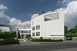 Town hall of Prague 17 | |
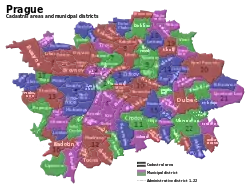 Location of Řepy within Prague (Green on the left) | |
| Coordinates: 50°4′8″N 14°18′13″E / 50.06889°N 14.30361°E | |
| Country | Czech Republic |
| City | Prague 6 |
| District | Prague 17 |
| Incorporated into Prague | 1968 |
| Area | |
| • Total | 3.26 km2 (1.26 sq mi) |
| Population (2012) | |
| • Total | 25,070 |
| • Density | 7,700/km2 (20,000/sq mi) |
| Postal code | 163 00 |
Řepy is a district in the west of Prague, located in and making up most of Prague 17 district, part of Prague 6 administrative region.
Education
The Japanese School of Prague is in the district.[1]
Neighbouring districts
References
50°04′08″N 14°18′13″E / 50.06889°N 14.30361°E
This article is issued from Wikipedia. The text is licensed under Creative Commons - Attribution - Sharealike. Additional terms may apply for the media files.