| Abrams Run Tributary to West Fork River | |
|---|---|
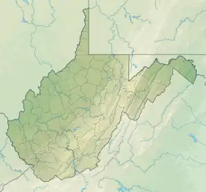 Location of Abrams Run mouth  Abrams Run (the United States) | |
| Location | |
| Country | United States |
| State | West Virginia |
| County | Lewis |
| Physical characteristics | |
| Source | Big Run divide |
| • location | west of Haytack Knob |
| • coordinates | 38°50′16″N 080°28′50″W / 38.83778°N 80.48056°W[1] |
| • elevation | 1,250 ft (380 m)[2] |
| Mouth | West Fork River |
• location | Emmart, West Virginia |
• coordinates | 38°52′43″N 080°28′42″W / 38.87861°N 80.47833°W[1] |
• elevation | 1,073 ft (327 m)[3] |
| Length | 2.42 mi (3.89 km)[4] |
| Basin size | 3.04 square miles (7.9 km2)[5] |
| Discharge | |
| • location | West Fork River |
| • average | 5.80 cu ft/s (0.164 m3/s) at mouth with West Fork River[5] |
| Basin features | |
| Progression | West Fork River → Monongahela River → Ohio River → Mississippi River → Gulf of Mexico |
| River system | Ohio River |
| Tributaries | |
| • left | unnamed tributaries |
| • right | unnamed tributaries |
| Bridges | WV 46 (Abrams Run Road) (x3) |
Abrams Run is a stream in the U.S. state of West Virginia.[6]
Abrams Run has the name of Abram Bennett, a pioneer who settled there.[7]
Variant names
According to the Geographic Names Information System, it has also been known historically as:[1]
- Abram's Run
Course
Abrams Run rises west of Haytack Knob, in Lewis County, West Virginia and then flows generally northeast to join the West Fork River at Emmart.[3]
Watershed
Abrams Run drains 3.04 square miles (7.9 km2) of area, receives about 49.3 in/year of precipitation, has a wetness index of 284.52, and is about 78% forested.[5]
See also
References
- 1 2 3 "GNIS Detail - Abrams Run". geonames.usgs.gov. US Geological Survey. Retrieved 10 June 2021.
- ↑ "Get Maps". USGS Topoview. US Geological Survey. Retrieved 10 June 2021.
- 1 2 "Get Maps". USGS Topoview. US Geological Survey. Retrieved 10 June 2021.
- ↑ "ArcGIS Web Application". epa.maps.arcgis.com. US EPA. Retrieved 10 June 2021.
- 1 2 3 "Abrams Run Watershed Report". US EPA Geoviewer. US EPA. Retrieved 10 June 2021.
- ↑ U.S. Geological Survey Geographic Names Information System: Abrams Run
- ↑ Kenny, Hamill (1945). West Virginia Place Names: Their Origin and Meaning, Including the Nomenclature of the Streams and Mountains. Piedmont, WV: The Place Name Press. p. 72.
This article is issued from Wikipedia. The text is licensed under Creative Commons - Attribution - Sharealike. Additional terms may apply for the media files.