Bürserberg | |
|---|---|
 | |
 Coat of arms | |
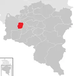 Location in the district | |
 Bürserberg Location within Austria | |
| Coordinates: 47°08′00″N 09°46′00″E / 47.13333°N 9.76667°E | |
| Country | Austria |
| State | Vorarlberg |
| District | Bludenz |
| Government | |
| • Mayor | Fridolin Plaickner |
| Area | |
| • Total | 13.73 km2 (5.30 sq mi) |
| Elevation | 871 m (2,858 ft) |
| Population (2018-01-01)[2] | |
| • Total | 572 |
| • Density | 42/km2 (110/sq mi) |
| Time zone | UTC+1 (CET) |
| • Summer (DST) | UTC+2 (CEST) |
| Postal code | 6707 |
| Area code | 05552 |
| Vehicle registration | BZ |
| Website | www.buerserberg.at |
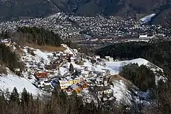
Bürserberg is a municipality in Austria in Vorarlberg in the Bludenz district with 549 inhabitants (as of January 1, 2020).
Population
| Year | Pop. | ±% |
|---|---|---|
| 1869 | 431 | — |
| 1880 | 451 | +4.6% |
| 1890 | 425 | −5.8% |
| 1900 | 393 | −7.5% |
| 1910 | 413 | +5.1% |
| 1923 | 385 | −6.8% |
| 1934 | 437 | +13.5% |
| 1939 | 415 | −5.0% |
| 1951 | 447 | +7.7% |
| 1961 | 447 | +0.0% |
| 1971 | 473 | +5.8% |
| 1981 | 479 | +1.3% |
| 2001 | 530 | +10.6% |
| 2011 | 523 | −1.3% |
References
- ↑ "Dauersiedlungsraum der Gemeinden Politischen Bezirke und Bundesländer - Gebietsstand 1.1.2018". Statistics Austria. Retrieved 10 March 2019.
- ↑ "Einwohnerzahl 1.1.2018 nach Gemeinden mit Status, Gebietsstand 1.1.2018". Statistics Austria. Retrieved 9 March 2019.
Wikimedia Commons has media related to Bürserberg.
This article is issued from Wikipedia. The text is licensed under Creative Commons - Attribution - Sharealike. Additional terms may apply for the media files.