Bhadmar | |
|---|---|
Village | |
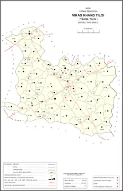 Map showing Bhadmar (#079) in Tiloi CD block | |
 Bhadmar Location in Uttar Pradesh, India | |
| Coordinates: 26°23′31″N 81°25′03″E / 26.392052°N 81.417511°E[1] | |
| Country India | |
| State | Uttar Pradesh |
| District | Raebareli |
| Area | |
| • Total | 2.887 km2 (1.115 sq mi) |
| Population (2011)[2] | |
| • Total | 2,038 |
| • Density | 710/km2 (1,800/sq mi) |
| Languages | |
| • Official | Hindi |
| Time zone | UTC+5:30 (IST) |
| PIN | 229308[2] |
| Vehicle registration | UP-35 |
Bhadmar is a village in Tiloi block of Rae Bareli district, Uttar Pradesh, India.[2] As of 2011, its population is 2,038, in 349 households.[2]
The 1961 census recorded Bhadmar as comprising 8 hamlets, with a total population of 929 people (468 male and 461 female), in 180 households and 171 physical houses.[3] The area of the village was given as 768 acres.[3]
The 1981 census recorded Bhadmar (here spelled "Bhadmra") as having a population of 1,070 people, in 209 households, and having an area of 308.77 hectares.[4]
References
- ↑ "Geographic Names Search WebApp". Search for "Bhadmar" here.
- 1 2 3 4 5 "Census of India 2011: Uttar Pradesh District Census Handbook - Rae Bareli, Part A (Village and Town Directory)" (PDF). Census 2011 India. pp. 142–58. Retrieved 31 July 2021.
- 1 2 Census 1961: District Census Handbook, Uttar Pradesh (39 - Raebareli District) (PDF). Lucknow. 1965. pp. xxii-xxiii of section "Maharajganj Tahsil". Retrieved 31 July 2021.
{{cite book}}: CS1 maint: location missing publisher (link) - ↑ Census 1981 Uttar Pradesh: District Census Handbook Part XIII-A: Village & Town Directory, District Rae Bareli (PDF). 1982. pp. 54–5. Retrieved 31 July 2021.
This article is issued from Wikipedia. The text is licensed under Creative Commons - Attribution - Sharealike. Additional terms may apply for the media files.