| Bowdoin Fjord | |
|---|---|
| Bowdoin Bay | |
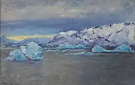 South Point, Bowdoin Bay. Painting by Frank Wilbert Stokes (1858 - 1955) | |
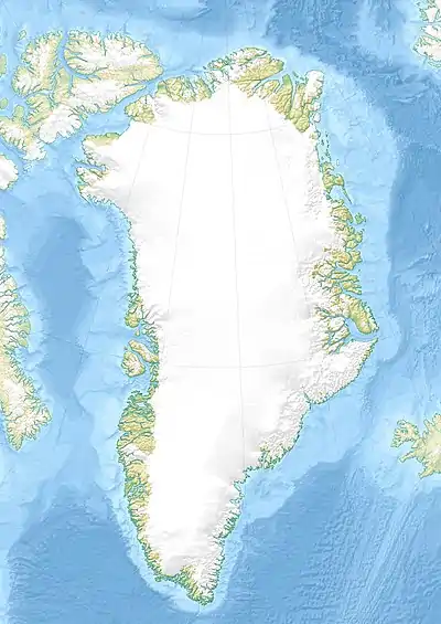 Bowdoin Fjord Location in Greenland | |
| Location | Arctic |
| Coordinates | 77°35′N 68°31′W / 77.583°N 68.517°W |
| Ocean/sea sources | Inglefield Gulf Baffin Bay |
| Basin countries | Greenland |
| Max. length | 22 km (14 mi) |
| Max. width | 4.5 km (2.8 mi) |
Bowdoin Fjord is a fjord in northern Greenland. To the south the fjord opens into the Inglefield Gulf of the Baffin Bay.[1]
This fjord was named by Robert Peary after his alma mater, Bowdoin College.[2] It was the subject of paintings by Frank Wilbert Stokes at the end of the 19th century.[3]
Geography
Bowdoin Fjord runs in a roughly north–south direction with its mouth west of Cape Milne and 15 km west of Cape Ackland, in the northern shore of the middle reaches of the Inglefield Gulf.[4] Piulip Nunaa is the peninsula that separates this fjord from MacCormick Fjord to the west and northwest; Bowdoin Fjord forms its eastern coastline. To the east lies Prudhoe Land. There is an Inuit settlement on the western shore of the fjord roughly 3 km north of Cape Tyrconnel.[5]
The Bowdoin Glacier discharges from the Greenland Ice Sheet at the head of the Bowdoin Fjord.[6]
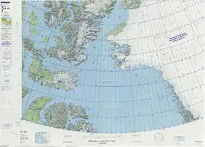 Map of Northwestern Greenland |
.jpg.webp) 19th century map of the Inglefield Gulf. |
See also
References
- ↑ GoogleEarth
- ↑ Robert Neff Keely, Gwilym George Davis, In Arctic Seas: the Voyage of the Kite with the Peary Expedition, 2011 p. 373
- ↑ Paintings by Frank Wilbert Stokes 1896
- ↑ "Bowdoin Fjord". Mapcarta. Retrieved 16 April 2019.
- ↑ Prostar Sailing Directions 2005 Greenland and Iceland Enroute, p. 90
- ↑ T. C. Chamberlin, Glacial Studies in Greenland. The Journal of Geology Vol. 5, No. 3 (Apr. - May, 1897), pp. 229-240. Published by: The University of Chicago Press
External links
 Media related to Bowdoin Fjord at Wikimedia Commons
- Greenland Institute of Natural Resources - Grønlands Naturinstitut