Changé | |
|---|---|
_-_Town_hall_-_4.jpg.webp) The town hall, in Changé | |
.svg.png.webp) Coat of arms | |
Location of Changé | |
 Changé 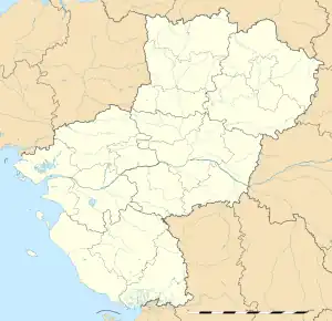 Changé | |
| Coordinates: 48°06′03″N 0°47′23″W / 48.1008°N 0.7897°W | |
| Country | France |
| Region | Pays de la Loire |
| Department | Mayenne |
| Arrondissement | Laval |
| Canton | Saint-Berthevin |
| Intercommunality | Laval Agglomération |
| Government | |
| • Mayor (2020–2026) | Patrick Peniguel[1] |
| Area 1 | 34.68 km2 (13.39 sq mi) |
| Population | 6,397 |
| • Density | 180/km2 (480/sq mi) |
| Time zone | UTC+01:00 (CET) |
| • Summer (DST) | UTC+02:00 (CEST) |
| INSEE/Postal code | 53054 /53810 |
| Elevation | 45–159 m (148–522 ft) (avg. 71 m or 233 ft) |
| 1 French Land Register data, which excludes lakes, ponds, glaciers > 1 km2 (0.386 sq mi or 247 acres) and river estuaries. | |
Changé (French pronunciation: [ʃɑ̃ʒe] ⓘ) is a commune in the Mayenne department in north-western France.
Population
| Year | Pop. | ±% p.a. |
|---|---|---|
| 1968 | 1,414 | — |
| 1975 | 2,002 | +5.09% |
| 1982 | 2,889 | +5.38% |
| 1990 | 4,323 | +5.17% |
| 1999 | 4,909 | +1.42% |
| 2007 | 5,265 | +0.88% |
| 2012 | 5,573 | +1.14% |
| 2017 | 6,020 | +1.56% |
| Source: INSEE[3] | ||
See also
References
- ↑ "Répertoire national des élus: les maires". data.gouv.fr, Plateforme ouverte des données publiques françaises (in French). 2 December 2020.
- ↑ "Populations légales 2021". The National Institute of Statistics and Economic Studies. 28 December 2023.
- ↑ Population en historique depuis 1968, INSEE
Wikimedia Commons has media related to Changé (Mayenne).
This article is issued from Wikipedia. The text is licensed under Creative Commons - Attribution - Sharealike. Additional terms may apply for the media files.