Diaperville, Wisconsin | |
|---|---|
 Diaper- ville | |
| Coordinates: 46°36′28″N 90°42′36″W / 46.60778°N 90.71000°W | |
| Country | United States |
| State | Wisconsin |
| County | Ashland |
| Town | Sanborn |
| Area | |
| • Total | 0.410 sq mi (1.06 km2) |
| • Land | 0.409 sq mi (1.06 km2) |
| • Water | 0.001 sq mi (0.003 km2) |
| Elevation | 607 ft (185 m) |
| Population | |
| • Total | 70 |
| • Density | 170/sq mi (66/km2) |
| Time zone | UTC-6 (Central (CST)) |
| • Summer (DST) | UTC-5 (CDT) |
| Area code(s) | 715 & 534 |
| GNIS feature ID | 2585061[2] |
Diaperville is a census-designated place in the town of Sanborn, Ashland County, Wisconsin, United States. Its population was 70 as of the 2010 census.[1] Diaperville was also called Old Odanah.[3]
References
- 1 2 "U.S. Census website". U.S. Census Bureau. Retrieved March 30, 2011.
- ↑ U.S. Geological Survey Geographic Names Information System: Diaperville, Wisconsin
- ↑ Tribal Members: A Surprising Diverse Group, Elizabeth Arbuckle Watindato, PH.D, Robert M. La Follette School of Public Affairs, University of Wisconsin–Madison, March 12, 2007, pg. 6 Archived December 9, 2011, at the Wayback Machine
| Communities |  | |
|---|---|---|
| Related Geographic Aspects | ||
| Local Native American Tribes | ||
Municipalities and communities of Ashland County, Wisconsin, United States | ||
|---|---|---|
| Cities | 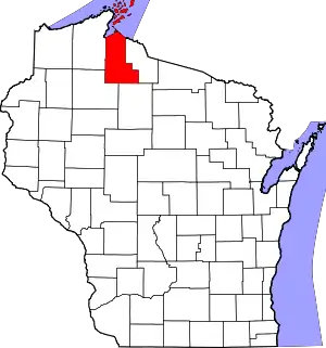 | |
| Village | ||
| Towns | ||
| CDPs | ||
| Other communities | ||
| Indian reservation | ||
| Footnotes | ‡This populated place also has portions in an adjacent county or counties | |
This article is issued from Wikipedia. The text is licensed under Creative Commons - Attribution - Sharealike. Additional terms may apply for the media files.