Eibiswald | |
|---|---|
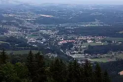 Eibiswald from south | |
 Coat of arms | |
 Eibiswald Location within Austria | |
| Coordinates: 46°41′12″N 15°14′50″E / 46.68667°N 15.24722°E | |
| Country | Austria |
| State | Styria |
| District | Deutschlandsberg |
| Government | |
| • Mayor | Andreas Thürschweller (SPÖ) |
| Area | |
| • Total | 152.14 km2 (58.74 sq mi) |
| Elevation | 362 m (1,188 ft) |
| Population (2018-01-01)[2] | |
| • Total | 6,485 |
| • Density | 43/km2 (110/sq mi) |
| Time zone | UTC+1 (CET) |
| • Summer (DST) | UTC+2 (CEST) |
| Postal code | 8552, 8553, 8554 |
| Area code | +43 3466, 3468, 3460 |
| Vehicle registration | DL |
| Website | www.eibiswald.gv.at |
Eibiswald (German: [ˈaɪ̯bisˌvalt]; Slovene: Ivnik) is a municipality in the district of Deutschlandsberg in the Austrian state of Styria.
Population
| Year | Pop. | ±% |
|---|---|---|
| 1869 | 1,079 | — |
| 1880 | 969 | −10.2% |
| 1890 | 1,135 | +17.1% |
| 1900 | 1,173 | +3.3% |
| 1910 | 1,023 | −12.8% |
| 1923 | 925 | −9.6% |
| 1934 | 924 | −0.1% |
| 1939 | 959 | +3.8% |
| 1951 | 1,093 | +14.0% |
| 1961 | 1,198 | +9.6% |
| 1971 | 1,377 | +14.9% |
| 1981 | 1,526 | +10.8% |
| 1991 | 1,568 | +2.8% |
| 2001 | 1,476 | −5.9% |
| 2011 | 1,378 | −6.6% |
| 2016 | 6,792 | +392.9% |
References
- ↑ "Dauersiedlungsraum der Gemeinden Politischen Bezirke und Bundesländer - Gebietsstand 1.1.2018". Statistics Austria. Retrieved 10 March 2019.
- ↑ "Einwohnerzahl 1.1.2018 nach Gemeinden mit Status, Gebietsstand 1.1.2018". Statistics Austria. Retrieved 9 March 2019.
This article is issued from Wikipedia. The text is licensed under Creative Commons - Attribution - Sharealike. Additional terms may apply for the media files.