Irwin, Ohio | |
|---|---|
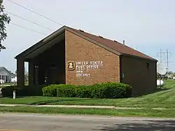 Post office | |
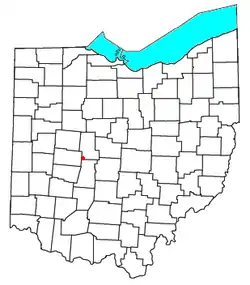 Location of Irwin, Ohio | |
| Coordinates: 40°07′21″N 83°29′22″W / 40.12250°N 83.48944°W | |
| Country | United States |
| State | Ohio |
| Counties | Union |
| Elevation | 1,010 ft (308 m) |
| Time zone | UTC-5 (Eastern (EST)) |
| • Summer (DST) | UTC-4 (EDT) |
| ZIP code | 43029[2] |
| Area code | 614 |
| GNIS feature ID | 1064891[1] |
Irwin is an unincorporated community in southwestern Union Township, Union County, Ohio, United States. It is located at 40°07′21″N 83°29′22″W / 40.12250°N 83.48944°W,[3] at the intersection of Ohio State Route 4 and 161.[4] Irwin has a post office which serves the surrounding area, including the community of Rosedale.
History
A post office has been in operation at Irwin since 15 May 1858.[5] The community was named for one Mr. Irwin, a pioneer settler.[6]
Located near Irwin is Elmwood Place, a historic farm that is listed on the National Register of Historic Places.[7]
References
- 1 2 "US Board on Geographic Names". United States Geological Survey. October 25, 2007. Retrieved January 31, 2008.
- ↑ USPS – Cities by ZIP Code
- ↑ U.S. Geological Survey Geographic Names Information System: Irwin, Ohio
- ↑ Rand McNally. The Road Atlas '06. Chicago: Rand McNally, 2006, 78.
- ↑ U.S. Geological Survey Geographic Names Information System: Irwin Post Office
- ↑ Durant, Pliny A. (1883). The History of Union County, Ohio, containing a history of the county; its townships, towns ... Chicago: Beers, W. H., & co. p. 195.
- ↑ "National Register Information System". National Register of Historic Places. National Park Service. March 13, 2009.
Municipalities and communities of Union County, Ohio, United States | ||
|---|---|---|
| Cities | 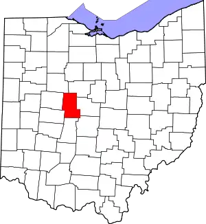 Map of Ohio highlighting Union County | |
| Villages | ||
| Townships | ||
| CDPs | ||
| Unincorporated communities | ||
| Ghost town | ||
| Footnotes | ‡This populated place also has portions in an adjacent county or counties | |
This article is issued from Wikipedia. The text is licensed under Creative Commons - Attribution - Sharealike. Additional terms may apply for the media files.