Haaltert | |
|---|---|
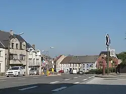 Kerksken | |
 Flag  Coat of arms | |
Location of Haaltert | |
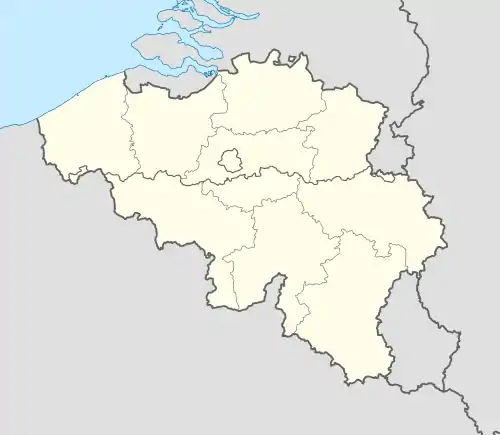 Haaltert Location in Belgium
Location of Haaltert in East Flanders 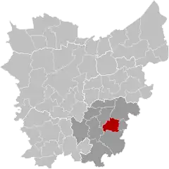 | |
| Coordinates: 50°54′N 04°00′E / 50.900°N 4.000°E | |
| Country | |
| Community | Flemish Community |
| Region | Flemish Region |
| Province | East Flanders |
| Arrondissement | Aalst |
| Government | |
| • Mayor | Veerle Baeyens (N-VA) |
| • Governing party/ies | N-VA, CD&V, Vooruit |
| Area | |
| • Total | 30.52 km2 (11.78 sq mi) |
| Population (2018-01-01)[1] | |
| • Total | 18,443 |
| • Density | 600/km2 (1,600/sq mi) |
| Postal codes | 9450, 9451 |
| NIS code | 41024 |
| Area codes | 053 |
| Website | www.haaltert.be |
Haaltert (Dutch pronunciation: [ˈɦaːltərt]) is a municipality located in the Belgian province of East Flanders in the Denderstreek. The municipality comprises the towns of Denderhoutem, Haaltert proper, Heldergem and Kerksken. In 2021, Haaltert had a total population of 18,892. The total area is 30.30 km².[2] The current mayor of Haaltert is Veerle Baeyens, from the N-VA.
There is a 205 hectare nature reserve Den Dotter in the sub-municipalities of Aaigem (municipality Erpe-Mere) and Heldergem (municipality Haaltert). Haaltert is crossed by the Molenbeek-Ter Erpenbeek creek in Heldergem, Kerksken, and Haaltert.
Gallery
 Saint Gorik church
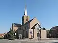 Kerksken, church
.jpg.webp) Statue of Priest Daens in Ede
Statue of Priest Daens in Ede
References
- ↑ "Wettelijke Bevolking per gemeente op 1 januari 2018". Statbel. Retrieved 9 March 2019.
- ↑ "Bevolking per statistische sector - Sector 41024". Statistics Belgium. Retrieved 9 May 2022.
External links
- Official website (in Dutch)
 Media related to Haaltert at Wikimedia Commons
Places adjacent to Haaltert | ||||||||||||||||
|---|---|---|---|---|---|---|---|---|---|---|---|---|---|---|---|---|
| ||||||||||||||||
| Aalst | 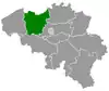 | |
|---|---|---|
| Dendermonde | ||
| Eeklo | ||
| Ghent | ||
| Oudenaarde | ||
| Sint-Niklaas | ||
| ||
This article is issued from Wikipedia. The text is licensed under Creative Commons - Attribution - Sharealike. Additional terms may apply for the media files.