Kirchberg an der Raab | |
|---|---|
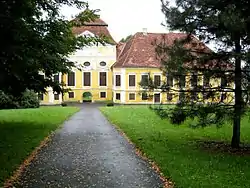 Kirchberg Castle | |
 Coat of arms | |
 Kirchberg an der Raab Location within Austria 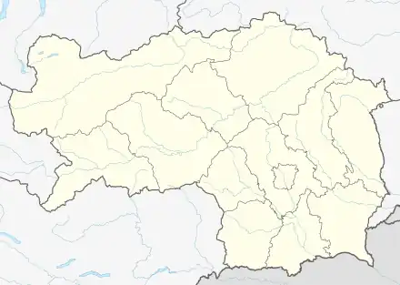 Kirchberg an der Raab Location within Styria | |
| Coordinates: 46°59′00″N 15°46′00″E / 46.98333°N 15.76667°E | |
| Country | Austria |
| State | Styria |
| District | Südoststeiermark |
| Government | |
| • Mayor | Helmut Ofner (ÖVP) |
| Area | |
| • Total | 43.79 km2 (16.91 sq mi) |
| Elevation | 370 m (1,210 ft) |
| Population (2018-01-01)[2] | |
| • Total | 4,488 |
| • Density | 100/km2 (270/sq mi) |
| Time zone | UTC+1 (CET) |
| • Summer (DST) | UTC+2 (CEST) |
| Postal code | 8324 |
| Area code | +43 3115 |
| Vehicle registration | SO |
| Website | www.kirchberg-raab.at |
Kirchberg an der Raab is a municipality in the district of Südoststeiermark in the Austrian state of Styria.
Population
| Year | Pop. | ±% |
|---|---|---|
| 1869 | 1,269 | — |
| 1880 | 1,384 | +9.1% |
| 1890 | 1,461 | +5.6% |
| 1900 | 1,508 | +3.2% |
| 1910 | 1,636 | +8.5% |
| 1923 | 1,574 | −3.8% |
| 1934 | 1,587 | +0.8% |
| 1939 | 1,519 | −4.3% |
| 1951 | 1,522 | +0.2% |
| 1961 | 1,516 | −0.4% |
| 1971 | 1,617 | +6.7% |
| 1981 | 1,623 | +0.4% |
| 1991 | 1,784 | +9.9% |
| 2001 | 1,892 | +6.1% |
| 2013 | 2,003 | +5.9% |
References
- ↑ "Dauersiedlungsraum der Gemeinden Politischen Bezirke und Bundesländer - Gebietsstand 1.1.2018". Statistics Austria. Retrieved 10 March 2019.
- ↑ "Einwohnerzahl 1.1.2018 nach Gemeinden mit Status, Gebietsstand 1.1.2018". Statistics Austria. Retrieved 9 March 2019.
This article is issued from Wikipedia. The text is licensed under Creative Commons - Attribution - Sharealike. Additional terms may apply for the media files.