Kohfidisch | |
|---|---|
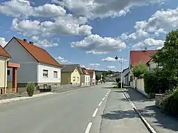 The main street in 2021 | |
 Coat of arms | |
 Kohfidisch Location within Austria | |
| Coordinates: 47°10′N 16°21′E / 47.167°N 16.350°E | |
| Country | Austria |
| State | Burgenland |
| District | Oberwart |
| Government | |
| • Mayor | Norbert Sulyok (ÖVP) |
| Area | |
| • Total | 31.34 km2 (12.10 sq mi) |
| Elevation | 258 m (846 ft) |
| Population (2018-01-01)[2] | |
| • Total | 1,462 |
| • Density | 47/km2 (120/sq mi) |
| Time zone | UTC+1 (CET) |
| • Summer (DST) | UTC+2 (CEST) |
| Postal code | 7512 |
| Area code | 03366 |
| Vehicle registration | OW |
| Website | www.kohfidisch.at |
Kohfidisch (German pronunciation: [koːˈfiːdɪʃ] ⓘ; Hungarian: Gyepűfüzes, Croatian: Gornji Fideš, Burgenland Croatian: Zgornji Fideš) is a municipality in the district of Oberwart in the Austrian state of Burgenland.
Geography
The municipality is composed of the main town Kohfidisch and the two villages Kirchfidisch (German pronunciation: [ˌkɪʁçˈfiːdɪʃ] ⓘ) and Harmisch.
Population
| Year | Pop. | ±% |
|---|---|---|
| 1869 | 1,357 | — |
| 1880 | 1,492 | +9.9% |
| 1890 | 1,566 | +5.0% |
| 1900 | 1,746 | +11.5% |
| 1910 | 1,697 | −2.8% |
| 1923 | 1,521 | −10.4% |
| 1934 | 1,583 | +4.1% |
| 1939 | 1,504 | −5.0% |
| 1951 | 1,467 | −2.5% |
| 1961 | 1,478 | +0.7% |
| 1971 | 1,611 | +9.0% |
| 1981 | 1,625 | +0.9% |
| 1991 | 1,492 | −8.2% |
| 2001 | 1,472 | −1.3% |
| 2011 | 1,444 | −1.9% |
References
- ↑ "Dauersiedlungsraum der Gemeinden Politischen Bezirke und Bundesländer - Gebietsstand 1.1.2018". Statistics Austria. Retrieved 10 March 2019.
- ↑ "Einwohnerzahl 1.1.2018 nach Gemeinden mit Status, Gebietsstand 1.1.2018". Statistics Austria. Retrieved 9 March 2019.
This article is issued from Wikipedia. The text is licensed under Creative Commons - Attribution - Sharealike. Additional terms may apply for the media files.