Kothwan
Kothawan | |
|---|---|
Populated place | |
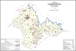 Map showing Kothwan (#781) in Kothwan CD block | |
| Country | |
| State | Uttar Pradesh |
| District | Hardoi |
| Area | |
| • Total | 5.895 km2 (2.276 sq mi) |
| Population (2011)[1] | |
| • Total | 5,323 |
| • Density | 900/km2 (2,300/sq mi) |
| Languages | |
| • Official | Hindi |
| Time zone | UTC+5:30 (IST) |
Kothwan, also spelled Kothawan, is a village and corresponding community development block in Hardoi district of Uttar Pradesh, India.[1] Located 8 km from the city of Beniganj,[2] Kothwan hosts a Parikrma fair during the month of Phalguna where people gather for worship purposes.[3] Vendors bring various items of merchandise to sell at the fair, including carpets, handloom cloth, glassware, earthen pots, toys, and sweets.[3] Kothwan also hosts a market on Wednesdays and Sundays,[3][2] which involves the sale of miscellaneous products.[3] The main staple foods in Kothwan are wheat and rice.[2] As of 2011, the population of Kothwan is 5,323, in 1,063 households.[1]
Demographic history
The 1961 census recorded an average attendance of about 500 people at the biweekly market in Kothwan.[3] Average attendance of the Parikrma fair was listed as 9,000 people at the time.[3]
The 1981 census recorded Kothwan as having a population of 2,570, in 523 households, and covering an area of 582.36 hectares.[2]
Villages
Kothwan CD block has the following 86 villages:[1]
| Village name | Total land area (hectares) | Population (in 2011) |
|---|---|---|
| Ghrohia | 1,050.7 | 6,380 |
| Pipri | 1,243.1 | 4,159 |
| Mamrejpur | 849.2 | 4,175 |
| Newada Lochan | 543.8 | 3,005 |
| Beniganj Dehat | 1,267.3 | 6,352 |
| Sikanderpur | 1,423.8 | 5,374 |
| Umrari | 529 | 3,826 |
| Girdharpur | 289 | 2,194 |
| Sadipur | 186.4 | 1,302 |
| Kursi | 207.9 | 1,744 |
| Muthiya | 481.4 | 4,260 |
| Ant Sant | 454.4 | 4,266 |
| Kauro Kalla | 437.4 | 3,152 |
| Manghgawn | 1,773.5 | 11,562 |
| Ugpur | 691 | 4,612 |
| Kothawan (block headquarters) | 589.5 | 5,323 |
| Gauri | 53 | 562 |
| Nagwa | 737.4 | 5,392 |
| Lalpur | 12.2 | 29 |
| Gegalapur | 165.1 | 1,246 |
| Hulaspur | 72.5 | 388 |
| Laudhora | 107.8 | 881 |
| Maghnapur | 70.9 | 350 |
| Shahpur | 104.8 | 1,082 |
| Govrha | 97.7 | 594 |
| Tewna | 404.1 | 2,775 |
| Beruwa | 1,422.3 | 8,490 |
| Bhdsen | 282 | 1,557 |
| Antwa | 771.1 | 4,701 |
| Farenda | 705.7 | 4,504 |
| Mahmoodpur | 129.2 | 403 |
| Alhawa | 431.1 | 1,437 |
| Mahua Kola | 179.1 | 1,001 |
| Chapar Talla | 357.4 | 1,258 |
| Rampur | 334.1 | 2,775 |
| Kakupur | 284.8 | 2,126 |
| Laudh Khera | 34 | 464 |
| Kulman Khera | 51.1 | 991 |
| Manikapur | 91 | 724 |
| Bhatpurwa | 97.6 | 737 |
| Bahadurpur | 145.9 | 1,029 |
| Dubra | 29.4 | 341 |
| Anandpur | 39.7 | 173 |
| Jarowa | 326.4 | 2,299 |
| Shiupuri | 169.6 | 1,189 |
| Purwa Waji Rao | 175.1 | 1,766 |
| Shyampur | 218.7 | 1,916 |
| Kamalpur | 92.2 | 451 |
| Malhpur | 84.8 | 1,097 |
| Adampur | 188.1 | 1,198 |
| Aema | 170.1 | 554 |
| Paliya Ray Singh | 230.3 | 1,303 |
| Raghunathpur | 85.4 | 127 |
| Bhelawan | 52.7 | 617 |
| Jagdispur | 78.2 | 415 |
| Kakrali | 61.5 | 286 |
| Pirkapur | 117.6 | 1,488 |
| Thana | 205.9 | 1,642 |
| Rampur | 35.3 | 75 |
| Mahmoodpur | 57.4 | 474 |
| Teriya | 119.8 | 1,015 |
| Chuglahar | 49.4 | 117 |
| Mathura Garhi | 52 | 265 |
| Bhengaon | 634 | 3,387 |
| Ashapur | 161.6 | 472 |
| Kalhepur | 217.2 | 1,087 |
| Katghara | 181.5 | 724 |
| Atsaliya Bhour | 154.8 | 640 |
| Harraiya | 1,263 | 4,624 |
| Kansuwa | 145.6 | 801 |
| Barsanda | 457.5 | 2,233 |
| Arkha | 53.6 | 337 |
| Pakra Diwan | 66.7 | 197 |
| Kalyanmal | 1,164.2 | 8,295 |
| Keema | 57.4 | 356 |
| Korori | 39.2 | 421 |
| Fantehpur | 359.9 | 1,070 |
| Bhikhpur Eama | 709.8 | 2,573 |
| Gathiya | 288.4 | 959 |
| Raypur | 176.3 | 843 |
| Shankarpur | 201.7 | 783 |
| Jaitapur | 40.9 | 279 |
| Naramadnapur | 354.3 | 1,269 |
| Harpalpur | 177.2 | 1,481 |
| Janigaon | 875.7 | 5,817 |
| Jugrajpur | 231.3 | 1,011 |
References
- 1 2 3 4 5 "Census of India 2011: Uttar Pradesh District Census Handbook - Hardoi, Part A (Village and Town Directory)" (PDF). Census 2011 India. pp. 389–406. Retrieved 14 June 2021.
- 1 2 3 4 Census 1981 Uttar Pradesh: District Census Handbook Part XIII-A: Village & Town Directory, District Hardoi (PDF). 1982. pp. 234–5. Retrieved 14 June 2021.
- 1 2 3 4 5 6 Census 1961: District Census Handbook, Uttar Pradesh (36 - Hardoi District) (PDF). Lucknow. 1965. pp. 160–1, 168. Retrieved 14 June 2021.
{{cite book}}: CS1 maint: location missing publisher (link)