Lafnitz | |
|---|---|
 | |
 Coat of arms | |
 Lafnitz Location within Austria | |
| Coordinates: 47°22′09″N 16°00′46″E / 47.36917°N 16.01278°E | |
| Country | Austria |
| State | Styria |
| District | Hartberg-Fürstenfeld |
| Government | |
| • Mayor | Hans Hammer (SPÖ) |
| Area | |
| • Total | 15.54 km2 (6.00 sq mi) |
| Elevation | 412 m (1,352 ft) |
| Population (2018-01-01)[2] | |
| • Total | 1,451 |
| • Density | 93/km2 (240/sq mi) |
| Time zone | UTC+1 (CET) |
| • Summer (DST) | UTC+2 (CEST) |
| Postal code | 8233, 8230 |
| Area code | 03338 |
| Vehicle registration | HB |
| Website | www.lafnitz.at |
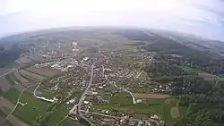
Lafnitz (German pronunciation: [ˈlafnɪt͡s] ⓘ) is a municipality in the district of Hartberg-Fürstenfeld in Styria, Austria. It is situated on the upper course of the river Lafnitz.
References
- ↑ "Dauersiedlungsraum der Gemeinden Politischen Bezirke und Bundesländer - Gebietsstand 1.1.2018". Statistics Austria. Retrieved 10 March 2019.
- ↑ "Einwohnerzahl 1.1.2018 nach Gemeinden mit Status, Gebietsstand 1.1.2018". Statistics Austria. Retrieved 9 March 2019.
This article is issued from Wikipedia. The text is licensed under Creative Commons - Attribution - Sharealike. Additional terms may apply for the media files.