Langouet
| |
|---|---|
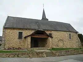 Saint-Armel church | |
Location of Langouet | |
 Langouet  Langouet | |
| Coordinates: 48°15′02″N 1°49′19″W / 48.2506°N 1.8219°W | |
| Country | France |
| Region | Brittany |
| Department | Ille-et-Vilaine |
| Arrondissement | Rennes |
| Canton | Melesse |
| Intercommunality | Val d'Ille-Aubigné |
| Government | |
| • Mayor (2020–2026) | Jean-Luc Dubois[1] |
| Area 1 | 6.99 km2 (2.70 sq mi) |
| Population | 617 |
| • Density | 88/km2 (230/sq mi) |
| Time zone | UTC+01:00 (CET) |
| • Summer (DST) | UTC+02:00 (CEST) |
| INSEE/Postal code | 35146 /35630 |
| Elevation | 71–121 m (233–397 ft) |
| 1 French Land Register data, which excludes lakes, ponds, glaciers > 1 km2 (0.386 sq mi or 247 acres) and river estuaries. | |
Langouet (French pronunciation: [lɑ̃ɡwɛt]; Gallo: Langouët, Breton: Langoed) is a commune in the Ille-et-Vilaine department of Brittany in northwestern France.
Population
Inhabitants of Langouet are called Langouëtiens in French.
| Year | Pop. | ±% |
|---|---|---|
| 1962 | 257 | — |
| 1968 | 278 | +8.2% |
| 1975 | 317 | +14.0% |
| 1982 | 418 | +31.9% |
| 1990 | 454 | +8.6% |
| 1999 | 537 | +18.3% |
| 2008 | 553 | +3.0% |
See also
References
- ↑ "Répertoire national des élus: les maires" (in French). data.gouv.fr, Plateforme ouverte des données publiques françaises. 13 September 2022.
- ↑ "Populations légales 2021". The National Institute of Statistics and Economic Studies. 28 December 2023.
External links
Wikimedia Commons has media related to Langouet.
- Mayors of Ille-et-Vilaine Association (in French);
This article is issued from Wikipedia. The text is licensed under Creative Commons - Attribution - Sharealike. Additional terms may apply for the media files.