| Loue | |
|---|---|
 | |
.png.webp) | |
| Location | |
| Country | France |
| Physical characteristics | |
| Source | |
| • location | Massif Central |
| Mouth | |
• location | Isle |
• coordinates | 45°18′19″N 0°58′22″E / 45.30528°N 0.97278°E |
| Length | 51 km (32 mi) |
| Basin size | 198 km2 (76 sq mi) |
| Discharge | |
| • average | 2.91 m3/s (103 cu ft/s) at Saint-Médard-d'Excideuil |
| Basin features | |
| Progression | Isle→ Dordogne→ Gironde estuary→ Atlantic Ocean |
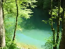
The Loue (French pronunciation: [lu]; Occitan: Loa) is a 51 km long river in the Nouvelle-Aquitaine region of France. It is a tributary of the Isle, itself a tributary of the Dordogne.[1]
The source of the river is in the commune of Saint-Yrieix-la-Perche in the Massif Central. It runs through the Haute-Vienne department, and empties into the Isle near Coulaures in the Dordogne department. Its main tributaries are the Haute Loue and the Ravillou.
Places
- Haute-Vienne: Saint-Yrieix-la-Perche
- Dordogne: Excideuil, Coulaures
Hydrology
The mean annual discharge, measured at Saint-Médard-d'Excideuil, is 2.91 m3/s. The highest flow was measured during a flash flood on September 22, 1993: 111 m3/s (daily average).[2]
References
This article is issued from Wikipedia. The text is licensed under Creative Commons - Attribution - Sharealike. Additional terms may apply for the media files.