Native name: Lulunga | |
|---|---|
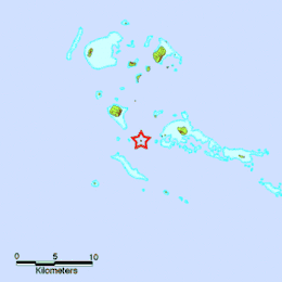 Map of Lulunga | |
| Geography | |
| Location | Pacific Ocean |
| Coordinates | 20°03′07″S 174°43′52″W / 20.052°S 174.731°W |
| Archipelago | Tonga Islands |
| Administration | |
Tonga | |
| Haʻapai | |
| Largest settlement | Haʻafeva township (pop. ~300) |
| Demographics | |
| Population | 923(Census 2016[1]) |
| Ethnic groups | Tongan |
Lulunga is an island group[2] and a district in Haʻapai administrative division of the Kingdom of Tonga. The archipelago consists of 17 islands, only 5 of which are inhabited. These are Haʻafeva, Matuku, Kotu, ʻOʻua and Tungua. The population of the whole island chain is 923,[1] most of whom live on Haʻafeva.
List of islands
References
- 1 2 "Population and Housing Census | Tonga Statistics Department".
- ↑ "Lulunga Group: Tonga". Geographical Names. Retrieved 30 January 2021.
This article is issued from Wikipedia. The text is licensed under Creative Commons - Attribution - Sharealike. Additional terms may apply for the media files.