Mamund Tehsil
تحصیل ماموند ماموند تحصیل | |
|---|---|
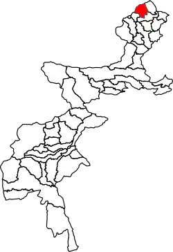 Location of Mamund Subdivision in the former Federally Administered Tribal Areas | |
| Country | |
| Region | |
| District | Bajaur District |
| Established | 1960 |
| Population | |
| • Total | 311,873 |
| Time zone | UTC+5 (PST) |
Mamund Tehsil (Pashto: ماموند) is a subdivision located in Bajaur District, Khyber Pakhtunkhwa, Pakistan. Mamund is the largest tehsil of district Bajaur.
History
Bajaur was declared as a subdivision of the former Malakand Agency in 1960, and Mamund was established as a tehsil within the Bajaur subdivision. Bajaur was declared a Federally Administered Tribal Agency in December 1973.[2] Mamund Subdivision joined Khyber Pakhtunkhwa on May 31, 2018 with the merger of the Federally Administered Tribal Areas. It was previously a tehsil before the FATA Interim Governance Regulation, 2018 was signed by President Mamnoon Hussain. With FATA's merger to Khyber Pakhtunkhwa, its status was upgraded to a subdivision.[3]
Geography
Adjacent administrative units
- Dangam District, Kunar Province, Afghanistan (north)
- Salarzai Subdivision (northeast)
- Khar Bajaur Subdivision (south)
- Nawagai Subdivision (southwest)
- Sirkanay District, Kunar Province, Afghanistan (northwest)
- Marawara District, Kunar Province, Afghanistan (northwest)
Demographics
| Year | Pop. | ±% p.a. |
|---|---|---|
| 1981 | 83,102 | — |
| 1998 | 168,283 | +4.24% |
| 2017 | 311,873 | +3.30% |
| [4][1] | ||
Mamund Subdivision has a population of 311,873 and has 35,269 households according to the 2017 census.[1]
See also
References
- 1 2 3 "DISTRICT AND TEHSIL LEVEL POPULATION SUMMARY WITH REGION BREAKUP [PDF]" (PDF). Pakistan Bureau of Statistics. 2018-01-03. Archived from the original (PDF) on 2018-03-26. Retrieved 2018-03-25.
- ↑ "Situation Analysis & Baseline Surveys For Poverty Reduction through Rural Development in KPK, FATA & Balochistan: Development Profile of Bajaur Agency" (PDF). Pakistan Poverty Alleviation Fund, AASA Consulting. 2015-01-03. Retrieved 2018-05-11.
- ↑ Khan, Ismail (2018-05-31). "Mainstreaming Fata with interim governance law". Dawn. Pakistan Herald Publications. Retrieved 2018-06-02.
- ↑ "AVERAGE HOUSEHOLD SIZE AND GROWTH RATE - FATA TABLE 3 - AREA, POPULATION BY SEX, SEX RATIO, POPULATION DENSITY" (PDF). Pakistan Bureau of Statistics. Archived from the original (PDF) on 2018-05-08. Retrieved 2018-05-11.
| North F.A.T.A. |
| ||||||||
|---|---|---|---|---|---|---|---|---|---|
| South F.A.T.A. |
| ||||||||