Mandromodromotra | |
|---|---|
 Pointe Evatra in Mandromodromotra | |
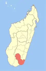
 Mandromodromotra Location in Madagascar | |
| Coordinates: 24°55′S 47°2′E / 24.917°S 47.033°E | |
| Country | |
| Region | Anosy |
| District | Taolanaro |
| Elevation | 13 m (43 ft) |
| Population (2001)[2] | |
| • Total | 4,000 |
| Time zone | UTC3 (EAT) |
Mandromodromotra is a rural municipality in Madagascar. It belongs to the district of Taolanaro, which is a part of Anosy Region. The population of the commune was estimated to be approximately 4,000 in 2001 commune census.[2]
Only primary schooling is available. The majority 50% of the population of the commune are farmers, while an additional 10% receives their livelihood from raising livestock. The most important crop is rice, while other important products are lychee, cassava and sweet potatoes. Industry and services provide employment for 2% and 3% of the population, respectively. Additionally fishing employs 35% of the population.[2]
Roads
This municipality is crossed by the National road 12a,[3] 17 km[4] from Fort-Dauphin.
References and notes
- ↑ Estimated based on DEM data from Shuttle Radar Topography Mission
- 1 2 3 "ILO census data". Cornell University. 2002. Retrieved 2008-05-04.
- ↑ Chantier RN 12A
- ↑ Université d'Antananarivo
Capital: Fort Dauphin (Taolagnaro) | ||
| Amboasary Sud (18) - 603 |
|  |
| Betroka (20) - 613 | ||
| Taolagnaro (24) - 614 | ||
3 districts; 62 communes | ||
24°55′S 47°2′E / 24.917°S 47.033°E