Manuelito, New Mexico | |
|---|---|
 Manuelito  Manuelito | |
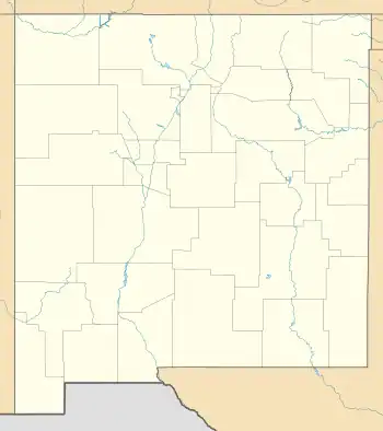
| Coordinates: 35°25′21″N 108°59′45″W / 35.42250°N 108.99583°W | |
| Country | United States |
| State | New Mexico |
| County | McKinley |
| Area | |
| • Total | 8.16 sq mi (21.15 km2) |
| • Land | 8.16 sq mi (21.15 km2) |
| • Water | 0.00 sq mi (0.00 km2) |
| Elevation | 6,270 ft (1,910 m) |
| Population | |
| • Total | 68 |
| • Density | 8.33/sq mi (3.22/km2) |
| Time zone | UTC-7 (Mountain (MST)) |
| • Summer (DST) | UTC-6 (MDT) |
| ZIP Code | 87319 (Mentmore) |
| Area code | 505 |
| FIPS code | 35-46660 |
| GNIS feature ID | 2813407[3] |
Manuelito is a census-designated place (CDP) on the Navajo Nation in McKinley County, New Mexico, United States. It was first listed as a CDP prior to the 2020 census.[3]
Demographics
| Census | Pop. | Note | %± |
|---|---|---|---|
| 2020 | 68 | — | |
| U.S. Decennial Census[4][2] | |||
Description
The community is in the western part of the county in the valley of the Puerco River, 16 miles (26 km) southwest of Gallup, the county seat, and 3 miles (5 km) east of the Arizona border. New Mexico State Road 118 (Historic Route 66) and Interstate 40 pass through the community. The closest I-40 access is from Exit 8 (NM 118), 3 miles (5 km) to the northeast.
Education
The community is within the Gallup-McKinley County Public Schools.[5]
Zoned schools are: Tobe Turpen Elementary School, Chief Manualito Middle School, and Gallup High School.[6]
See also
References
- ↑ "ArcGIS REST Services Directory". United States Census Bureau. Retrieved October 12, 2022.
- 1 2 "Census Population API". United States Census Bureau. Retrieved October 12, 2022.
- 1 2 "Manuelito Census Designated Place". Geographic Names Information System. United States Geological Survey, United States Department of the Interior.
- ↑ "Census of Population and Housing". Census.gov. Retrieved June 4, 2016.
- ↑ "2020 CENSUS - SCHOOL DISTRICT REFERENCE MAP: McKinley County, NM" (PDF). U.S. Census Bureau. Retrieved July 20, 2021.
- ↑ "GMCS Address Lookup". Gallup-McKinley County Schools. Retrieved January 15, 2022. - KML files: Elementary boundaries and locations, Middle boundaries and locations, and High boundaries and locations.
External links
![]() Media related to Manuelito, New Mexico at Wikimedia Commons
Media related to Manuelito, New Mexico at Wikimedia Commons
Municipalities and communities of McKinley County, New Mexico, United States | ||
|---|---|---|
| City | 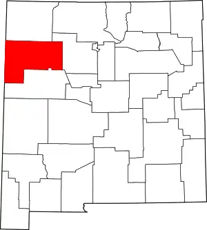 Map of New Mexico highlighting McKinley County | |
| CDPs |
| |
| Other communities | ||
| Indian reservation | ||
| Footnotes | ‡This populated place also has portions in an adjacent county or counties | |
| Tónaneezdizí (Western Agency) | |
|---|---|
| Chʼínílį́ (Chinle Agency) | |
| Tséhootsooí (Fort Defiance Agency) | |
| Naatʼáaniinééz (Shiprock Agency) | |
| Tʼiistsʼózí (Eastern Agency) | |