| Mount Clarence Wyckoff | |
|---|---|
| Clarence Wyckoff Fjeld | |
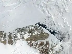 Satellite image of the northern end of Greenland | |
| Highest point | |
| Elevation | 853 m (2,799 ft)[1] |
| Prominence | 290 m (950 ft)[2] |
| Listing | |
| Coordinates | 82°48′N 23°20′W / 82.800°N 23.333°W[3] |
| Geography | |
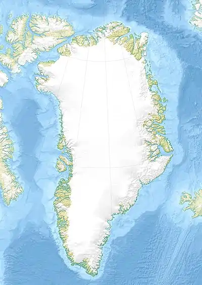 Mount Clarence Wyckoff Peary Land, Greenland | |
| Parent range | Peary Land |
Mount Clarence Wyckoff (Danish: Clarence Wyckoff Fjeld or Clarence Wyckoff Bjerg)[4] is a mountain in Peary Land, Northern Greenland. Administratively the mountain belongs to the Northeast Greenland National Park.[3]
The peak was named after Clarence F. Wyckoff, one of the members of the Peary Arctic Club in New York.[5]
The Wyckoff Bjerg Formation is named after the mountain. Fossils dating back to the Cambrian have been found in it.[6][7]
Geography
Mount Clarence Wyckoff is located to the north of Herlufsholm Strand, 18.5 kilometres (11 mi) northwest of Cape Henry Parish.[8] Rising above the eastern shore of Hellefisk Fjord, the 853 metres (2,799 ft) high peak is the highest in the coastal area.[1] The same mountain is mentioned as a 951 metres (3,120 ft) high peak with a prominence of 290 m (950 ft) according to other sources.[2]
See also
References
- 1 2 PGC MapKap Eiler Rasmussen - 405 - GRL REF-MT0503-042
- 1 2 "Clarence Wyckoff Fjeld, Greenland". Peakery. Retrieved 9 December 2022.
- 1 2 Google Maps
- ↑ Nunat Aqqi; Stednavne
- ↑ XIV. Der Peary Arctic Club - Projekt Gutenberg
- ↑ H.P. Trettin (ed.), Geology of the Innuitian Orogen and Arctic Platform of Canada and Greenland. p. 208
- ↑ Geological map of Greenland
- ↑ Greenland Pilot