Naujan | |
|---|---|
| Municipality of Naujan | |
 Naujan Church | |
 Flag  Seal | |
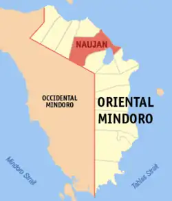 Map of Oriental Mindoro with Naujan highlighted | |
OpenStreetMap | |
.svg.png.webp) Naujan Location within the Philippines | |
| Coordinates: 13°19′24″N 121°18′10″E / 13.32328°N 121.30282°E | |
| Country | Philippines |
| Region | Mimaropa |
| Province | Oriental Mindoro |
| District | 1st district |
| Founded | 1693 |
| Incorporated | 1905 |
| Barangays | 70 (see Barangays) |
| Government | |
| • Type | Sangguniang Bayan |
| • Mayor | Henry Joel C. Teves |
| • Vice Mayor | Great M. Delos Reyes |
| • Representative | Arnan C. Panaligan |
| • Electorate | 64,507 voters (2022) |
| Area | |
| • Total | 503.10 km2 (194.25 sq mi) |
| Elevation | 99 m (325 ft) |
| Highest elevation | 476 m (1,562 ft) |
| Lowest elevation | 0 m (0 ft) |
| Population (2020 census)[3] | |
| • Total | 109,587 |
| • Density | 220/km2 (560/sq mi) |
| • Households | 26,504 |
| Economy | |
| • Income class | 1st municipal income class |
| • Poverty incidence | 12.41 |
| • Revenue | ₱ 357.3 million (2020) |
| • Assets | ₱ 1,169 million (2020) |
| • Expenditure | ₱ 323.2 million (2020) |
| • Liabilities | ₱ 249.3 million (2020) |
| Service provider | |
| • Electricity | Oriental Mindoro Electric Cooperative (ORMECO) |
| Time zone | UTC+8 (PST) |
| ZIP code | 5204 |
| PSGC | |
| IDD : area code | +63 (0)43 |
| Native languages | Alangan Tagalog |
Naujan, officially the Municipality of Naujan (Tagalog: Bayan ng Naujan), is a 1st class municipality in the province of Oriental Mindoro, Philippines. According to the 2020 census, it has a population of 109,587 people.[3]
History
On January 4, 1905, under Act 1280, Naujan assumed the status of a full-fledged municipality. Its boundaries were permanently established in 1919.
Geography
It covers a land area of 50,310 hectares (124,300 acres), making it the largest municipality in the province and accounting for 12% of the province's total land area. Naujan is 26 kilometres (16 mi) from Calapan.
Barangays
Naujan is politically subdivided into 71 barangays. Each barangay consists of puroks and some have sitios.
- Adrialuna
- Andres Ylagan (Mag-asawang Tubig)
- Antipolo
- Apitong
- Arangin
- Aurora
- Bacungan
- Bagong Buhay
- Balite
- Bancuro
- Banuton
- Barcenaga
- Bayani
- Buhangin
- Caburo
- Concepcion
- Dao
- Del Pilar
- Estrella
- Evangelista
- Gamao
- General Esco
- Herrera
- Inarawan
- Kalinisan
- Laguna
- Mabini
- Magtibay
- Mahabang Parang
- Malabo
- Malaya
- Malinao
- Malvar
- Masagana
- Masaguing
- Melgar A
- Melgar B
- Metolza
- Montelago
- Montemayor
- Motoderazo
- Mulawin
- Nag-Iba I
- Nag-Iba II
- Pagkakaisa
- Paitan
- Paniquian
- Pinagsabangan I
- Pinagsabangan II
- Pinahan
- Poblacion I Barangay I)
- Poblacion II (Barangay II)
- Poblacion III Barangay III)
- Sampaguita
- San Agustin I
- San Agustin II
- San Andres
- San Antonio
- San Carlos
- San Isidro
- San Jose
- San Luis
- San Nicolas
- San Pedro
- Santa Cruz
- Santa Isabel
- Santa Maria
- Santiago
- Santo Nino
- Tagumpay
- Tigkan
Climate
| Climate data for Naujan, Oriental Mindoro | |||||||||||||
|---|---|---|---|---|---|---|---|---|---|---|---|---|---|
| Month | Jan | Feb | Mar | Apr | May | Jun | Jul | Aug | Sep | Oct | Nov | Dec | Year |
| Mean daily maximum °C (°F) | 28 (82) |
29 (84) |
30 (86) |
31 (88) |
31 (88) |
30 (86) |
29 (84) |
29 (84) |
29 (84) |
29 (84) |
29 (84) |
28 (82) |
29 (85) |
| Mean daily minimum °C (°F) | 22 (72) |
21 (70) |
22 (72) |
23 (73) |
25 (77) |
25 (77) |
25 (77) |
25 (77) |
25 (77) |
24 (75) |
23 (73) |
22 (72) |
24 (74) |
| Average precipitation mm (inches) | 48 (1.9) |
32 (1.3) |
41 (1.6) |
54 (2.1) |
257 (10.1) |
410 (16.1) |
466 (18.3) |
422 (16.6) |
429 (16.9) |
300 (11.8) |
137 (5.4) |
92 (3.6) |
2,688 (105.7) |
| Average rainy days | 10.8 | 8.0 | 9.8 | 11.7 | 23.1 | 27.5 | 29.2 | 28.7 | 28.7 | 25.5 | 18.2 | 12.8 | 234 |
| Source: Meteoblue[5] | |||||||||||||
Demographics
| Year | Pop. | ±% p.a. |
|---|---|---|
| 1903 | 3,662 | — |
| 1918 | 9,139 | +6.29% |
| 1939 | 19,170 | +3.59% |
| 1948 | 22,382 | +1.74% |
| 1960 | 31,476 | +2.88% |
| 1970 | 45,685 | +3.79% |
| 1975 | 54,641 | +3.66% |
| 1980 | 61,216 | +2.30% |
| 1990 | 72,203 | +1.66% |
| 1995 | 75,726 | +0.90% |
| 2000 | 83,892 | +2.22% |
| 2007 | 90,629 | +1.07% |
| 2010 | 94,497 | +1.53% |
| 2015 | 102,998 | +1.65% |
| 2020 | 109,587 | +1.23% |
| Source: Philippine Statistics Authority[6][7][8][9] | ||
Economy
Government
2022Elected officials:
- Municipal Mayor: Henry Joel C.Teves
- Vice Mayor: Great Delos Reyes
- Sangguniang Bayan Members:
- Arago Toti, Councilor
- Vilma D. Vargas, Councilor
- Wil Viray, Councilor
- Howard Arteza, Councilor
- Joefel Ylagan, Councilor
- Elmar De villa, Councilor
- Allan Balbacal, Councilor
- Reuel Laygo, Councilor
- Engr. Ralph Jonnel D. Recto, ABC President
Wyne Wyvvky G. Delos Reyes, SKMF President<Sangguniang Bayan>
- Rogelio Banlugan, Indigenous Peoples Mandatory Representative
See also
References
- ↑ Municipality of Naujan | (DILG)
- ↑ "2015 Census of Population, Report No. 3 – Population, Land Area, and Population Density" (PDF). Philippine Statistics Authority. Quezon City, Philippines. August 2016. ISSN 0117-1453. Archived (PDF) from the original on May 25, 2021. Retrieved July 16, 2021.
- 1 2 Census of Population (2020). "Mimaropa". Total Population by Province, City, Municipality and Barangay. Philippine Statistics Authority. Retrieved 8 July 2021.
- ↑ "PSA Releases the 2018 Municipal and City Level Poverty Estimates". Philippine Statistics Authority. 15 December 2021. Retrieved 22 January 2022.
- ↑ "Naujan: Average Temperatures and Rainfall". Meteoblue. Retrieved 27 April 2020.
- ↑ Census of Population (2015). "Region IV-B (Mimaropa)". Total Population by Province, City, Municipality and Barangay. Philippine Statistics Authority. Retrieved 20 June 2016.
- ↑ Census of Population and Housing (2010). "Region IV-B (Mimaropa)" (PDF). Total Population by Province, City, Municipality and Barangay. National Statistics Office. Retrieved 29 June 2016.
- ↑ Censuses of Population (1903–2007). "Region IV-B (Mimaropa)". Table 1. Population Enumerated in Various Censuses by Province/Highly Urbanized City: 1903 to 2007. National Statistics Office.
{{cite encyclopedia}}: CS1 maint: numeric names: authors list (link) - ↑ "Province of Oriental Mindoro". Municipality Population Data. Local Water Utilities Administration Research Division. Retrieved 17 December 2016.
- ↑ "Poverty incidence (PI):". Philippine Statistics Authority. Retrieved December 28, 2020.
- ↑ "Estimation of Local Poverty in the Philippines" (PDF). Philippine Statistics Authority. 29 November 2005.
- ↑ "2003 City and Municipal Level Poverty Estimates" (PDF). Philippine Statistics Authority. 23 March 2009.
- ↑ "City and Municipal Level Poverty Estimates; 2006 and 2009" (PDF). Philippine Statistics Authority. 3 August 2012.
- ↑ "2012 Municipal and City Level Poverty Estimates" (PDF). Philippine Statistics Authority. 31 May 2016.
- ↑ "Municipal and City Level Small Area Poverty Estimates; 2009, 2012 and 2015". Philippine Statistics Authority. 10 July 2019.
- ↑ "PSA Releases the 2018 Municipal and City Level Poverty Estimates". Philippine Statistics Authority. 15 December 2021. Retrieved 22 January 2022.
External links
- Naujan Profile at PhilAtlas.com
- Philippine Standard Geographic Code
- Official website
- www-naujan-gov.blogspot.com
- Naujan.com
Places adjacent to Naujan | |
|---|---|
Calapan (capital and largest city) | |
| Municipalities | |
| Component city | |