Ortaca | |
|---|---|
District and municipality | |
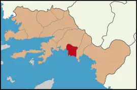 Map showing Ortaca District in Muğla Province | |
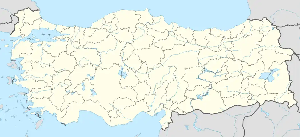 Ortaca Location in Turkey  Ortaca Ortaca (Turkey Aegean) | |
| Coordinates: 36°50′20″N 28°45′52″E / 36.83889°N 28.76444°E | |
| Country | Turkey |
| Province | Muğla |
| Government | |
| • Mayor | Alim Uzundemir (MHP) |
| Area | 285 km2 (110 sq mi) |
| Elevation | 29 m (95 ft) |
| Population (2022)[1] | 54,478 |
| • Density | 190/km2 (500/sq mi) |
| Time zone | TRT (UTC+3) |
| Postal code | 48600 |
| Area code | 0252 |
| Website | www |
Ortaca (Turkish pronunciation: [oɾtadʒa]) is a municipality and district of Muğla Province, Turkey.[2] Its area is 285 km2, and its population is 54,478 (2022).[3][1] Formerly a township part of Köyceğiz district, it was made into a separate district in 1987.[4]
Ortaca's economy is based on agriculture. It lies midway between Dalaman and Köyceğiz. Its name literally means "the town in the middle", possibly a reference to its location in the middle of the surrounding plain and is indeed a regional hub. The town pulls benefits from this fertile plain and the economy largely depends on tomatoes, citrus fruits, cotton and pomegranates.
Composition
There are 27 neighbourhoods in Ortaca District:[5]
- Akıncı
- Arıkbaşı
- Atatürk
- Bahçelievler
- Beşköprü
- Çaylı
- Cumhuriyet
- Dalaklı
- Dalyan
- Dereköy
- Dikmekavak
- Ekşiliyurt
- Eskiköy
- Fevziye
- Gökbel
- Gölbaşı
- Güzelyurt
- Karaburun
- Karadonlar
- Kemaliye
- Mergenli
- Okçular
- Sarıgerme
- Tepearası
- Terzialiler
- Yerbelen
- Yeşilyurt
See also
References
- 1 2 "Address-based population registration system (ADNKS) results dated 31 December 2022, Favorite Reports" (XLS). TÜİK. Retrieved 19 September 2023.
- ↑ Büyükşehir İlçe Belediyesi, Turkey Civil Administration Departments Inventory. Retrieved 19 September 2023.
- ↑ "İl ve İlçe Yüz ölçümleri". General Directorate of Mapping. Retrieved 19 September 2023.
- ↑ "İl İdaresi ve Mülki Bölümler Şube Müdürlüğü İstatistikleri - İl ve İlçe Kuruluş Tarihleri" (PDF) (in Turkish). p. 64. Retrieved 27 September 2023.
- ↑ Mahalle, Turkey Civil Administration Departments Inventory. Retrieved 19 September 2023.
External links
- District municipality's official website (in Turkish)
Ortaca in Muğla Province of Turkey | |||||||||||||||||||||||||||
|---|---|---|---|---|---|---|---|---|---|---|---|---|---|---|---|---|---|---|---|---|---|---|---|---|---|---|---|
| Districts | 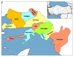 Districts of Muğla | ||||||||||||||||||||||||||
| |||||||||||||||||||||||||||
Metropolitan municipalities are bolded. | |||||||||||||||||||||||||||
This article is issued from Wikipedia. The text is licensed under Creative Commons - Attribution - Sharealike. Additional terms may apply for the media files.