Périgny | |
|---|---|
 The church in Périgny | |
Location of Périgny | |
 Périgny 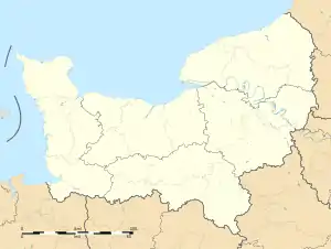 Périgny | |
| Coordinates: 48°55′22″N 0°36′14″W / 48.9227°N 0.6038°W | |
| Country | France |
| Region | Normandy |
| Department | Calvados |
| Arrondissement | Vire |
| Canton | Condé-en-Normandie |
| Intercommunality | Intercom de la Vire au Noireau |
| Government | |
| • Mayor (2020–2026) | Jean-Christophe Meunier[1] |
| Area 1 | 2.66 km2 (1.03 sq mi) |
| Population | 56 |
| • Density | 21/km2 (55/sq mi) |
| Time zone | UTC+01:00 (CET) |
| • Summer (DST) | UTC+02:00 (CEST) |
| INSEE/Postal code | 14496 /14770 |
| Elevation | 120–232 m (394–761 ft) (avg. 214 m or 702 ft) |
| 1 French Land Register data, which excludes lakes, ponds, glaciers > 1 km2 (0.386 sq mi or 247 acres) and river estuaries. | |
Périgny (French pronunciation: [peʁiɲi] ⓘ) is a commune in the Calvados department in the Normandy region in northwestern France.
The commune is part of the area known as Suisse Normande.[3]
Population
| Year | Pop. | ±% |
|---|---|---|
| 1962 | 80 | — |
| 1968 | 77 | −3.7% |
| 1975 | 60 | −22.1% |
| 1982 | 47 | −21.7% |
| 1990 | 53 | +12.8% |
| 1999 | 62 | +17.0% |
| 2008 | 53 | −14.5% |
See also
References
- ↑ "Répertoire national des élus: les maires". data.gouv.fr, Plateforme ouverte des données publiques françaises (in French). 9 August 2021.
- ↑ "Populations légales 2021". The National Institute of Statistics and Economic Studies. 28 December 2023.
- ↑ "Map of Suiss Normande" (PDF).
External links
Wikimedia Commons has media related to Périgny (Calvados).
- History and stories from Périgny (in French)
This article is issued from Wikipedia. The text is licensed under Creative Commons - Attribution - Sharealike. Additional terms may apply for the media files.