Point of Pines, Arizona | |
|---|---|
 Point of Pines Location within the state of Arizona  Point of Pines Point of Pines (the United States) | |
| Coordinates: 33°21′57″N 109°45′05″W / 33.36583°N 109.75139°W | |
| Country | United States |
| State | Arizona |
| County | Graham |
| Elevation | 5,922 ft (1,805 m) |
| Time zone | UTC-7 (Mountain (MST)) |
| • Summer (DST) | UTC-7 (MST) |
| Area code | 928 |
| FIPS code | 04-56860 |
| GNIS feature ID | 9596 |
Point of Pines is a populated place situated on the San Carlos Apache Indian Reservation in Graham County, Arizona, United States.[2] It has an estimated elevation of 5,922 feet (1,805 m) above sea level.[1]
References
- 1 2 "Feature Detail Report for: Point of Pines". Geographic Names Information System. United States Geological Survey, United States Department of the Interior.
- ↑ "Point of Pines (in Graham County, AZ) Populated Place Profile". AZ Hometown Locator. Retrieved January 31, 2017.
Municipalities and communities of Graham County, Arizona, United States | ||
|---|---|---|
| City | 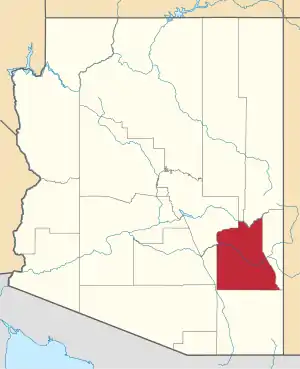 | |
| Towns | ||
| CDPs | ||
| Populated places | ||
| Indian reservations | ||
| Ghost towns | ||
| Footnotes | ‡This populated place also has portions in an adjacent county or counties | |
This article is issued from Wikipedia. The text is licensed under Creative Commons - Attribution - Sharealike. Additional terms may apply for the media files.