Ratschendorf | |
|---|---|
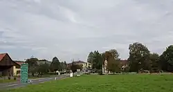 View of Ratschendorf | |
 Coat of arms | |
 Ratschendorf Location within Austria | |
| Coordinates: 46°44′40″N 15°49′00″E / 46.74444°N 15.81667°E | |
| Country | Austria |
| State | Styria |
| District | Südoststeiermark |
| Government | |
| • Mayor | Anton Stradner (ÖVP) |
| Area | |
| • Total | 10.39 km2 (4.01 sq mi) |
| Elevation | 240 m (790 ft) |
| Population (1 January 2016)[1] | |
| • Total | 619 |
| • Density | 60/km2 (150/sq mi) |
| Time zone | UTC+1 (CET) |
| • Summer (DST) | UTC+2 (CEST) |
| Postal code | 8483 |
| Area code | 03474 |
| Vehicle registration | RA |
| Website | www.ratschendorf.at |
Ratschendorf (Slovene: Račja vas) is a former municipality in the district of Südoststeiermark in the Austrian state of Styria. Since the 2015 Styria municipal structural reform, it is part of the municipality Deutsch Goritz.[2]
Population
| Year | Pop. | ±% |
|---|---|---|
| 1869 | 657 | — |
| 1880 | 700 | +6.5% |
| 1890 | 740 | +5.7% |
| 1900 | 705 | −4.7% |
| 1910 | 726 | +3.0% |
| 1923 | 722 | −0.6% |
| 1934 | 760 | +5.3% |
| 1939 | 723 | −4.9% |
| 1951 | 749 | +3.6% |
| 1961 | 673 | −10.1% |
| 1971 | 663 | −1.5% |
| 1981 | 684 | +3.2% |
| 1991 | 679 | −0.7% |
| 2001 | 624 | −8.1% |
| 2012 | 619 | −0.8% |
References
This article is issued from Wikipedia. The text is licensed under Creative Commons - Attribution - Sharealike. Additional terms may apply for the media files.