| Scrubgrass Run Tributary to Chartiers Creek | |
|---|---|
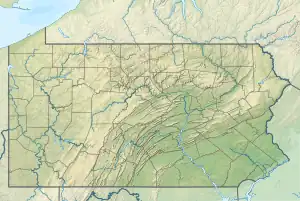 Location of Scrubgrass Run mouth  Scrubgrass Run (the United States) | |
| Location | |
| Country | United States |
| State | Pennsylvania |
| County | Allegheny |
| Physical characteristics | |
| Source | Saw Mill Run divide |
| • location | Mt. Lebanon, Pennsylvania |
| • coordinates | 40°23′14″N 080°03′34″W / 40.38722°N 80.05944°W[1] |
| • elevation | 1,058 ft (322 m)[2] |
| Mouth | Chartiers Creek |
• location | Heidelberg, Pennsylvania |
• coordinates | 40°23′15″N 080°05′19″W / 40.38750°N 80.08861°W[1] |
• elevation | 780 ft (240 m)[3] |
| Length | 2.24 mi (3.60 km)[4] |
| Basin size | 1.55 square miles (4.0 km2)[5] |
| Discharge | |
| • location | Chartiers Creek |
| • average | 1.65 cu ft/s (0.047 m3/s) at mouth with Chartiers Creek[5] |
| Basin features | |
| Progression | Chartiers Creek → Ohio River → Mississippi River → Gulf of Mexico[4] |
| River system | Ohio River |
| Tributaries | |
| • left | unnamed tributaries |
| • right | unnamed tributaries |
| Bridges | Elm Spring Road, Scrubgrass Road, Segar Road, Raven Drive, Scrubgrass Road, Old Scrubgrass Road, Greentree Road |
Scrubgrass Run is a 2.24 mi (3.60 km) long 1st order tributary to Chartiers Creek in Allegheny County, Pennsylvania.
Course
Scrubgrass Run rises in Mt. Lebanon, Pennsylvania and then flows west-southwest to join Chartiers Creek across from Heidelberg.[3]
Watershed
Scrubgrass Run drains 1.55 square miles (4.0 km2) of area, receives about 38.5 in/year of precipitation, has a wetness index of 331.29, and is about 15% forested.[5]
See also
References
- 1 2 "GNIS Detail - Scrubgrass Run". geonames.usgs.gov. US Geological Survey. Retrieved 13 May 2021.
- ↑ "Get Maps". USGS Topoview. US Geological Survey. Retrieved 13 May 2021.
- 1 2 "Get Maps". USGS Topoview. US Geological Survey. Retrieved 13 May 2021.
- 1 2 "ArcGIS Web Application". epa.maps.arcgis.com. US EPA. Retrieved 13 May 2021.
- 1 2 3 "Scrubgrass Run Watershed Report". US EPA Geoviewer. US EPA. Retrieved 13 May 2021.
This article is issued from Wikipedia. The text is licensed under Creative Commons - Attribution - Sharealike. Additional terms may apply for the media files.