Sergeac | |
|---|---|
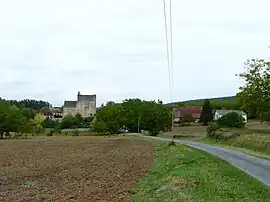 A general view of Sergeac | |
Location of Sergeac | |
 Sergeac 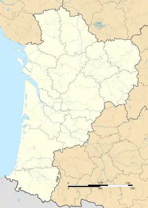 Sergeac | |
| Coordinates: 45°00′12″N 1°06′26″E / 45.0033°N 1.1072°E | |
| Country | France |
| Region | Nouvelle-Aquitaine |
| Department | Dordogne |
| Arrondissement | Sarlat-la-Canéda |
| Canton | Vallée de l'Homme |
| Government | |
| • Mayor (2020–2026) | Isabelle Daumas-Castanet[1] |
| Area 1 | 10.71 km2 (4.14 sq mi) |
| Population | 213 |
| • Density | 20/km2 (52/sq mi) |
| Time zone | UTC+01:00 (CET) |
| • Summer (DST) | UTC+02:00 (CEST) |
| INSEE/Postal code | 24531 /24290 |
| Elevation | 66–271 m (217–889 ft) (avg. 70 m or 230 ft) |
| 1 French Land Register data, which excludes lakes, ponds, glaciers > 1 km2 (0.386 sq mi or 247 acres) and river estuaries. | |
Sergeac (French pronunciation: [sɛʁʒak]; Occitan: Sarjac) is a commune in the Dordogne department in Nouvelle-Aquitaine in southwestern France.
Population
The area of Sergeac is 10.71 km2.
| Year | Pop. | ±% p.a. |
|---|---|---|
| 1968 | 137 | — |
| 1975 | 142 | +0.51% |
| 1982 | 133 | −0.93% |
| 1990 | 156 | +2.01% |
| 1999 | 172 | +1.09% |
| 2007 | 192 | +1.38% |
| 2012 | 221 | +2.85% |
| 2017 | 216 | −0.46% |
| Source: INSEE[3] | ||
Gallery
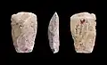 Neolithic polished ax - Muséum de Toulouse.
See also
References
- ↑ "Répertoire national des élus: les maires". data.gouv.fr, Plateforme ouverte des données publiques françaises (in French). 9 August 2021.
- ↑ "Populations légales 2021". The National Institute of Statistics and Economic Studies. 28 December 2023.
- ↑ Population en historique depuis 1968, INSEE
External links
Wikimedia Commons has media related to Sergeac.
This article is issued from Wikipedia. The text is licensed under Creative Commons - Attribution - Sharealike. Additional terms may apply for the media files.