Teufenbach | |
|---|---|
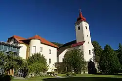 Neu-Teuffenbach Castle | |
 Coat of arms | |
 Teufenbach Location within Austria | |
| Coordinates: 47°07′43″N 14°21′32″E / 47.12861°N 14.35889°E | |
| Country | Austria |
| State | Styria |
| District | Murau |
| Government | |
| • Mayor | Johann Gruber (ÖVP) |
| Area | |
| • Total | 3.43 km2 (1.32 sq mi) |
| Elevation | 760 m (2,490 ft) |
| Population (1 January 2016)[1] | |
| • Total | 687 |
| • Density | 200/km2 (520/sq mi) |
| Time zone | UTC+1 (CET) |
| • Summer (DST) | UTC+2 (CEST) |
| Postal code | 8833 |
| Area code | 03582 |
| Vehicle registration | MU |
| Website | www.teufenbach.at |
Teufenbach is a former municipality in the district of Murau in the Austrian state of Styria. Since the 2015 Styria municipal structural reform, it is part of the municipality Teufenbach-Katsch.[2]
Geography
Teufenbach lies in the upper valley of the Mur.
References
This article is issued from Wikipedia. The text is licensed under Creative Commons - Attribution - Sharealike. Additional terms may apply for the media files.