Tinchebray | |
|---|---|
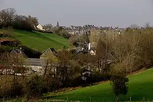
Part of Tinchebray-Bocage | |
 | |
Location of Tinchebray | |
 Tinchebray 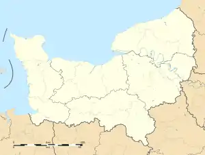 Tinchebray | |
| Coordinates: 48°45′49″N 0°43′59″W / 48.7636°N 0.7331°W | |
| Country | France |
| Region | Normandy |
| Department | Orne |
| Arrondissement | Argentan |
| Canton | Domfront |
| Commune | Tinchebray-Bocage |
| Area 1 | 26.52 km2 (10.24 sq mi) |
| Population (2019)[1] | 2,580 |
| • Density | 97/km2 (250/sq mi) |
| Demonym | Tinchebrayens |
| Time zone | UTC+01:00 (CET) |
| • Summer (DST) | UTC+02:00 (CEST) |
| Postal code | 61800 |
| Elevation | 152–311 m (499–1,020 ft) |
| Website | www.tinchebray.fr |
| 1 French Land Register data, which excludes lakes, ponds, glaciers > 1 km2 (0.386 sq mi or 247 acres) and river estuaries. | |
Tinchebray (French pronunciation: [tɛ̃ʃ(ə)bʁɛ] ⓘ) is a former commune in the Orne department in the Lower Normandy region in north-western France. On 1 January 2015, Tinchebray and six other communes merged becoming one commune called Tinchebray-Bocage.
History
It was the scene of the Battle of Tinchebray fought on 28 September 1106.
During the Second World War, it was liberated by Allied forces on 15th August 1944.[2]
Heraldry
.svg.png.webp) Arms of Tinchebray |
The arms of Tinchebray are blazoned : Gules, a key between 2 pairs of shuttles each pair in saltire argent, on a chief gules a lion passant between 2 fleurs de lys Or.
|
See also
References
Wikimedia Commons has media related to Tinchebray.
This article is issued from Wikipedia. The text is licensed under Creative Commons - Attribution - Sharealike. Additional terms may apply for the media files.