Tunsel | |
|---|---|
 Coat of arms | |
Location of Tunsel | |
 Tunsel 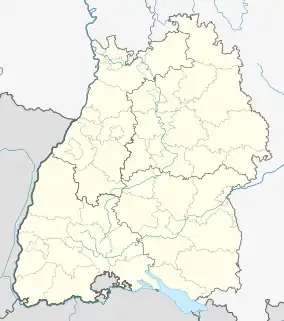 Tunsel | |
| Coordinates: 47°54′12″N 7°40′11″E / 47.90333°N 7.66972°E | |
| Country | Germany |
| State | Baden-Württemberg |
| Admin. region | Freiburg |
| District | Breisgau-Hochschwarzwald |
| Town | Bad Krozingen |
| Government | |
| • Local representative | Peter Ritzel (CDU) |
| Area | |
| • Total | 9.21 km2 (3.56 sq mi) |
| Elevation | 223 m (732 ft) |
| Population (2020)[1] | |
| • Total | 2,153 |
| • Density | 230/km2 (610/sq mi) |
| Time zone | UTC+01:00 (CET) |
| • Summer (DST) | UTC+02:00 (CEST) |
| Postal codes | 79189 |
| Dialling codes | 07633 |
| Vehicle registration | FR |
Tunsel is a village in the district of Breisgau-Hochschwarzwald in Baden-Württemberg. Since January 1974, it is an Ortsteil of Bad Krozingen.[2]
Gallery
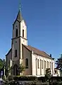 St. Michael Church
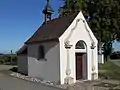 Maria-Hilf Kapelle (Our Lady Help of Christians Chapel)
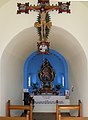 Inside Maria-Hilf Kapelle
References
- ↑ "Zahlen und Fakten". Stadt Bad Krozingen. Retrieved 24 September 2021.
- ↑ Stadt Bad Krozingen. "Ortsteil Tunsel" (in German). Archived from the original on 2018-03-17. Retrieved 2018-03-17.
Districts of Bad Krozingen | ||
|---|---|---|
Coat of arms | ||
This article is issued from Wikipedia. The text is licensed under Creative Commons - Attribution - Sharealike. Additional terms may apply for the media files.