Villers-Allerand | |
|---|---|
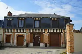 The town hall in Villers-Allerand | |
Location of Villers-Allerand | |
 Villers-Allerand 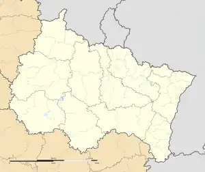 Villers-Allerand | |
| Coordinates: 49°10′00″N 4°01′33″E / 49.1667°N 4.0258°E | |
| Country | France |
| Region | Grand Est |
| Department | Marne |
| Arrondissement | Reims |
| Canton | Mourmelon-Vesle et Monts de Champagne |
| Intercommunality | CU Grand Reims |
| Government | |
| • Mayor (2020–2026) | Bernard Weiler[1] |
| Area 1 | 12.3 km2 (4.7 sq mi) |
| Population | 935 |
| • Density | 76/km2 (200/sq mi) |
| Time zone | UTC+01:00 (CET) |
| • Summer (DST) | UTC+02:00 (CEST) |
| INSEE/Postal code | 51629 /51500 |
| Elevation | 109–274 m (358–899 ft) |
| 1 French Land Register data, which excludes lakes, ponds, glaciers > 1 km2 (0.386 sq mi or 247 acres) and river estuaries. | |
Villers-Allerand (French pronunciation: [vilɛʁ alʁɑ̃]) is a commune in the Marne department in north-eastern France.
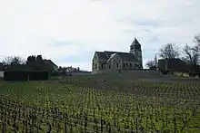
vineyard and church
See also
References
- ↑ "Répertoire national des élus: les maires" (in French). data.gouv.fr, Plateforme ouverte des données publiques françaises. 13 September 2022.
- ↑ "Populations légales 2021". The National Institute of Statistics and Economic Studies. 28 December 2023.
Wikimedia Commons has media related to Villers-Allerand.
This article is issued from Wikipedia. The text is licensed under Creative Commons - Attribution - Sharealike. Additional terms may apply for the media files.