| Vorya | |
|---|---|
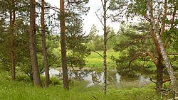 The Vorya near Ivanovskoye, Iznoskovsky District | |
| Native name | Воря (Russian) |
| Location | |
| Country | Russia |
| Physical characteristics | |
| Source | |
| • location | Nekrasovo, Moscow Oblast |
| • coordinates | 55°28′28″N 35°22′04″E / 55.47444°N 35.36778°E |
| Mouth | Ugra |
• coordinates | 54°53′50″N 34°59′41″E / 54.89722°N 34.99472°E |
| Length | 153 km (95 mi) |
| Basin size | 1,530 km2 (590 sq mi) |
| Basin features | |
| Progression | Ugra→ Oka→ Volga→ Caspian Sea |
The Vorya (Russian: Воря) is a river that flows through the Moscow and Smolensk Oblasts in Russia. The river is a left tributary of the Ugra, and its total length is 153 kilometers (95 mi) with a drainage basin of 1,530 square kilometers (590 sq mi).[1]
References
- ↑ "Воря" [Vorya]. State Water Register (in Russian). Retrieved 31 December 2020.
This article is issued from Wikipedia. The text is licensed under Creative Commons - Attribution - Sharealike. Additional terms may apply for the media files.