Weißenbach an der Enns | |
|---|---|
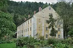 Granary in Weißenbach an der Enns | |
 Coat of arms | |
 Weißenbach an der Enns Location within Austria | |
| Coordinates: 47°42′21″N 14°37′47″E / 47.70583°N 14.62972°E | |
| Country | Austria |
| State | Styria |
| District | Liezen |
| Government | |
| • Mayor | Herbert Baumann (ÖVP) |
| Area | |
| • Total | 35.82 km2 (13.83 sq mi) |
| Elevation | 654 m (2,146 ft) |
| Population (1 January 2016)[1] | |
| • Total | 483 |
| • Density | 13/km2 (35/sq mi) |
| Time zone | UTC+1 (CET) |
| • Summer (DST) | UTC+2 (CEST) |
| Postal code | 8932 |
| Area code | 03632 |
| Vehicle registration | LI |
| Website | www.weissenbach-enns.steiermark.at |
Weißenbach an der Enns is a former municipality in the district of Liezen in the Austrian state of Styria. Since the 2015 Styria municipal structural reform, it is part of the municipality Sankt Gallen.[2]
Population
| Year | Pop. | ±% |
|---|---|---|
| 1869 | 962 | — |
| 1880 | 879 | −8.6% |
| 1890 | 971 | +10.5% |
| 1900 | 1,043 | +7.4% |
| 1910 | 1,115 | +6.9% |
| 1923 | 1,269 | +13.8% |
| 1934 | 1,268 | −0.1% |
| 1939 | 1,177 | −7.2% |
| 1951 | 1,250 | +6.2% |
| 1961 | 1,158 | −7.4% |
| 1971 | 1,004 | −13.3% |
| 1981 | 752 | −25.1% |
| 1991 | 646 | −14.1% |
| 2001 | 566 | −12.4% |
| 2011 | 501 | −11.5% |
References
This article is issued from Wikipedia. The text is licensed under Creative Commons - Attribution - Sharealike. Additional terms may apply for the media files.