Wielfresen | |
|---|---|
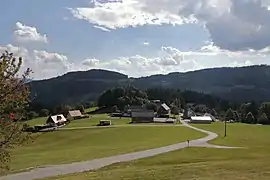 Wielfresen | |
 Coat of arms | |
 Wielfresen Location within Austria | |
| Coordinates: 46°43′32″N 15°10′25″E / 46.72556°N 15.17361°E | |
| Country | Austria |
| State | Styria |
| District | Deutschlandsberg |
| Government | |
| • Mayor | Karl Fürpass (ÖVP) |
| Area | |
| • Total | 43.84 km2 (16.93 sq mi) |
| Elevation | 620 m (2,030 ft) |
| Population (1 January 2016)[1] | |
| • Total | 577 |
| • Density | 13/km2 (34/sq mi) |
| Time zone | UTC+1 (CET) |
| • Summer (DST) | UTC+2 (CEST) |
| Postal code | 8541 |
| Area code | 03468 |
| Vehicle registration | DL |
| Website | www.wielfresen. steiermark.at |
Wielfresen is a former municipality in the district of Deutschlandsberg in the Austrian state of Styria. Since the 2015 Styria municipal structural reform, it is part of the municipality Wies.[2]
Population
| Year | Pop. | ±% |
|---|---|---|
| 1869 | 1,104 | — |
| 1880 | 1,101 | −0.3% |
| 1890 | 1,059 | −3.8% |
| 1900 | 1,023 | −3.4% |
| 1910 | 963 | −5.9% |
| 1923 | 964 | +0.1% |
| 1934 | 1,008 | +4.6% |
| 1939 | 995 | −1.3% |
| 1951 | 983 | −1.2% |
| 1961 | 960 | −2.3% |
| 1971 | 923 | −3.9% |
| 1981 | 852 | −7.7% |
| 1991 | 791 | −7.2% |
| 2001 | 698 | −11.8% |
| 2011 | 594 | −14.9% |
References
This article is issued from Wikipedia. The text is licensed under Creative Commons - Attribution - Sharealike. Additional terms may apply for the media files.