Xertigny | |
|---|---|
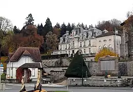 Chateau of the Brasseurs | |
 Coat of arms | |
Location of Xertigny | |
 Xertigny 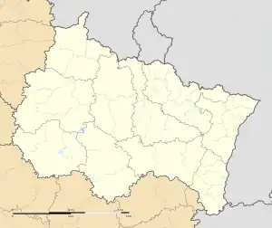 Xertigny | |
| Coordinates: 48°02′46″N 6°24′24″E / 48.0461°N 6.4067°E | |
| Country | France |
| Region | Grand Est |
| Department | Vosges |
| Arrondissement | Épinal |
| Canton | Le Val-d'Ajol |
| Intercommunality | Épinal |
| Government | |
| • Mayor (2020–2026) | Véronique Marcot[1] |
| Area 1 | 50.25 km2 (19.40 sq mi) |
| Population | 2,579 |
| • Density | 51/km2 (130/sq mi) |
| Time zone | UTC+01:00 (CET) |
| • Summer (DST) | UTC+02:00 (CEST) |
| INSEE/Postal code | 88530 /88220 |
| Elevation | 297–617 m (974–2,024 ft) (avg. 461 m or 1,512 ft) |
| Website | www.mairie-xertigny.fr |
| 1 French Land Register data, which excludes lakes, ponds, glaciers > 1 km2 (0.386 sq mi or 247 acres) and river estuaries. | |
Xertigny (French pronunciation: [ksɛʁtiɲi] ⓘ) is a commune in the Vosges department in Grand Est in northeastern France. Xertigny station has rail connections to Épinal, Lure and Belfort.
Population
| Year | Pop. | ±% p.a. |
|---|---|---|
| 1968 | 3,224 | — |
| 1975 | 3,075 | −0.67% |
| 1982 | 3,190 | +0.53% |
| 1990 | 2,971 | −0.89% |
| 1999 | 2,810 | −0.62% |
| 2007 | 2,795 | −0.07% |
| 2012 | 2,745 | −0.36% |
| 2017 | 2,611 | −1.00% |
| Source: INSEE[3] | ||
Geography
The Côney forms most of the commune's northwestern border.
Points of interest
See also
References
- ↑ "Répertoire national des élus: les maires". data.gouv.fr, Plateforme ouverte des données publiques françaises (in French). 2 December 2020.
- ↑ "Populations légales 2021". The National Institute of Statistics and Economic Studies. 28 December 2023.
- ↑ Population en historique depuis 1968, INSEE
External links
Wikimedia Commons has media related to Xertigny.
This article is issued from Wikipedia. The text is licensed under Creative Commons - Attribution - Sharealike. Additional terms may apply for the media files.