Akunk
Ակունք | |
|---|---|
.jpg.webp) | |
 Akunk 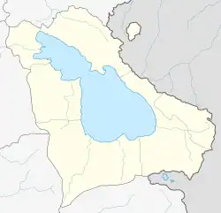 Akunk | |
| Coordinates: 40°09′26″N 45°43′35″E / 40.15722°N 45.72639°E | |
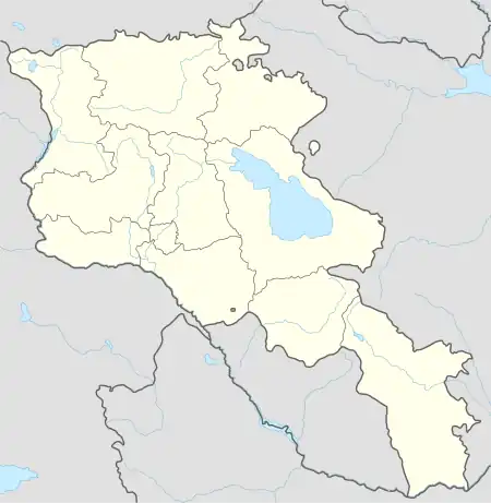
| Country | Armenia |
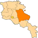
| Province | Gegharkunik |
| Municipality | Vardenis |
| Elevation | 1,965 m (6,447 ft) |
| Population | |
| • Total | 4,443 |
| Time zone | UTC+4 (AMT) |
| Postal code | 1604 |
| Akunk at GEOnet Names Server | |
Akunk (Armenian: Ակունք) is a village in the Vardenis Municipality of the Gegharkunik Province of Armenia.
History
The village was founded on the site of a Bronze Age settlement and to the west of Akunk, there is a cyclopean fort, Klor Dar, dating from between the 6th and 4th centuries BC. There are two Tukh Manuk pilgrimage sites in the village as well.[2]
Gallery
.jpg.webp) Khachkar and scenery near Akunk
Khachkar and scenery near Akunk.jpg.webp) Hin Gomer church ruin
Hin Gomer church ruin Klor Dar cyclopean fort, 6th-4th century BC.[3]
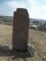 A khachkar, and a view of Akunk
.jpg.webp) Hin Gomer khachkars
Hin Gomer khachkars
References
Wikimedia Commons has media related to Akunk.
- ↑ Statistical Committee of Armenia. "The results of the 2011 Population Census of Armenia" (PDF).
- ↑ Kiesling, Brady; Kojian, Raffi (2005). Rediscovering Armenia: Guide (2nd ed.). Yerevan: Matit Graphic Design Studio. p. 82. ISBN 99941-0-121-8.
- ↑ Virtual Armenia - Gegharkunik
External links
- Report of the results of the 2001 Armenian Census, Statistical Committee of Armenia
- Kiesling, Brady (June 2000). Rediscovering Armenia: An Archaeological/Touristic Gazetteer and Map Set for the Historical Monuments of Armenia (PDF). Archived (PDF) from the original on 6 November 2021.
This article is issued from Wikipedia. The text is licensed under Creative Commons - Attribution - Sharealike. Additional terms may apply for the media files.