Bad Zell | |
|---|---|
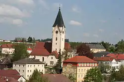 Church of Saint John the Baptist | |
 Coat of arms | |
 Bad Zell Location within Austria | |
| Coordinates: 48°21′0″N 14°40′0″E / 48.35000°N 14.66667°E | |
| Country | Austria |
| State | Upper Austria |
| District | Freistadt |
| Government | |
| • Mayor | Martin Moser (ÖVP) |
| Area | |
| • Total | 45.49 km2 (17.56 sq mi) |
| Elevation | 515 m (1,690 ft) |
| Population (2018-01-01)[2] | |
| • Total | 2,919 |
| • Density | 64/km2 (170/sq mi) |
| Time zone | UTC+1 (CET) |
| • Summer (DST) | UTC+2 (CEST) |
| Postal code | 4283 |
| Area code | 07263 |
| Vehicle registration | FR |
| Website | www.badzell.at |
Bad Zell is a municipality in the district of Freistadt in the Austrian state of Upper Austria.
Population
| Year | Pop. | ±% |
|---|---|---|
| 1869 | 2,277 | — |
| 1880 | 2,426 | +6.5% |
| 1890 | 2,371 | −2.3% |
| 1900 | 2,366 | −0.2% |
| 1910 | 2,456 | +3.8% |
| 1923 | 2,431 | −1.0% |
| 1934 | 2,280 | −6.2% |
| 1939 | 2,199 | −3.6% |
| 1951 | 2,307 | +4.9% |
| 1961 | 2,417 | +4.8% |
| 1971 | 2,571 | +6.4% |
| 1981 | 2,623 | +2.0% |
| 1991 | 2,687 | +2.4% |
| 2001 | 2,716 | +1.1% |
| 2011 | 2,753 | +1.4% |
References
- ↑ "Dauersiedlungsraum der Gemeinden Politischen Bezirke und Bundesländer - Gebietsstand 1.1.2018". Statistics Austria. Retrieved 10 March 2019.
- ↑ "Einwohnerzahl 1.1.2018 nach Gemeinden mit Status, Gebietsstand 1.1.2018". Statistics Austria. Retrieved 9 March 2019.
Wikimedia Commons has media related to Bad Zell.
This article is issued from Wikipedia. The text is licensed under Creative Commons - Attribution - Sharealike. Additional terms may apply for the media files.