Castello Tesino | |
|---|---|
| Comune di Castello Tesino | |
 | |
Location of Castello Tesino | |
 Castello Tesino Location of Castello Tesino in Italy 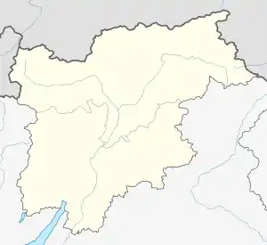 Castello Tesino Castello Tesino (Trentino-Alto Adige/Südtirol) | |
| Coordinates: 46°4′N 11°37′E / 46.067°N 11.617°E | |
| Country | Italy |
| Region | Trentino-Alto Adige/Südtirol |
| Province | Trentino (TN) |
| Frazioni | Coronini, Lissa and Roa |
| Area | |
| • Total | 112.84 km2 (43.57 sq mi) |
| Elevation | 905 m (2,969 ft) |
| Population (28 February 2017)[2] | |
| • Total | 1,207 |
| • Density | 11/km2 (28/sq mi) |
| Demonym | Castelazzi |
| Time zone | UTC+1 (CET) |
| • Summer (DST) | UTC+2 (CEST) |
| Postal code | 38053 |
| Dialing code | 0461 |
| Website | Official website |
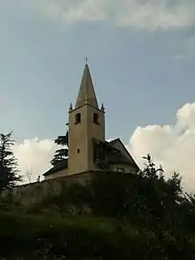
Church of Sant'Ippolito
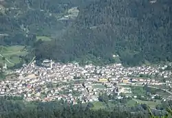
Castello Tesino (Castèl Tasìn or Castèlo in local dialect) is a comune (municipality) in Trentino in the northern Italian region Trentino-Alto Adige/Südtirol, located about 40 kilometres (25 mi) east of Trento.
Castello Tesino borders the following municipalities: Canal San Bovo, Pieve Tesino, Scurelle, Cinte Tesino, Lamon, Grigno, and Arsiè.
References
- ↑ "Superficie di Comuni Province e Regioni italiane al 9 ottobre 2011". Italian National Institute of Statistics. Retrieved 16 March 2019.
- ↑ All demographics and other statistics: Italian statistical institute Istat.

This article is issued from Wikipedia. The text is licensed under Creative Commons - Attribution - Sharealike. Additional terms may apply for the media files.