Ennevelin | |
|---|---|
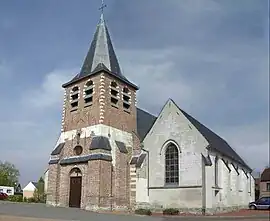 The church in Ennevelin | |
.svg.png.webp) Coat of arms | |
Location of Ennevelin | |
 Ennevelin 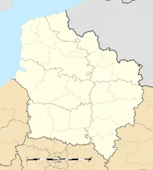 Ennevelin | |
| Coordinates: 50°32′32″N 3°07′49″E / 50.5422°N 3.1303°E | |
| Country | France |
| Region | Hauts-de-France |
| Department | Nord |
| Arrondissement | Lille |
| Canton | Templeuve-en-Pévèle |
| Intercommunality | Pévèle-Carembault |
| Government | |
| • Mayor (2020–2026) | Michel Dupont[1] |
| Area 1 | 9.92 km2 (3.83 sq mi) |
| Population | 2,356 |
| • Density | 240/km2 (620/sq mi) |
| Time zone | UTC+01:00 (CET) |
| • Summer (DST) | UTC+02:00 (CEST) |
| INSEE/Postal code | 59197 /59710 |
| Elevation | 26–42 m (85–138 ft) (avg. 33 m or 108 ft) |
| 1 French Land Register data, which excludes lakes, ponds, glaciers > 1 km2 (0.386 sq mi or 247 acres) and river estuaries. | |
Ennevelin (French pronunciation: [ɛnvəlɛ̃]) is a commune in the Nord department in northern France.[3]
Population
| Year | Pop. | ±% p.a. |
|---|---|---|
| 1968 | 1,078 | — |
| 1975 | 1,210 | +1.66% |
| 1982 | 1,474 | +2.86% |
| 1990 | 1,792 | +2.47% |
| 1999 | 1,973 | +1.07% |
| 2007 | 2,190 | +1.31% |
| 2012 | 2,129 | −0.56% |
| 2017 | 2,185 | +0.52% |
| Source: INSEE[4] | ||
Heraldry
Arms of Ennevelin |
The arms of Ennevelin are blazoned : Per pale and barry Or and azure.
|
See also
References
- ↑ "Répertoire national des élus: les maires". data.gouv.fr, Plateforme ouverte des données publiques françaises (in French). 2 December 2020.
- ↑ "Populations légales 2021". The National Institute of Statistics and Economic Studies. 28 December 2023.
- ↑ INSEE commune file
- ↑ Population en historique depuis 1968, INSEE
Wikimedia Commons has media related to Ennevelin.
This article is issued from Wikipedia. The text is licensed under Creative Commons - Attribution - Sharealike. Additional terms may apply for the media files.