Tourmignies | |
|---|---|
 St Peter's church, Tourmignies | |
 Coat of arms | |
Location of Tourmignies | |
 Tourmignies 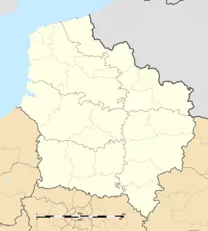 Tourmignies | |
| Coordinates: 50°30′27″N 3°05′06″E / 50.5075°N 3.085°E | |
| Country | France |
| Region | Hauts-de-France |
| Department | Nord |
| Arrondissement | Lille |
| Canton | Templeuve-en-Pévèle |
| Intercommunality | Pévèle-Carembault |
| Government | |
| • Mayor (2020–2026) | Alain Duchesne[1] |
| Area 1 | 2.03 km2 (0.78 sq mi) |
| Population | 947 |
| • Density | 470/km2 (1,200/sq mi) |
| Time zone | UTC+01:00 (CET) |
| • Summer (DST) | UTC+02:00 (CEST) |
| INSEE/Postal code | 59600 /59551 |
| Elevation | 37–49 m (121–161 ft) (avg. 57 m or 187 ft) |
| 1 French Land Register data, which excludes lakes, ponds, glaciers > 1 km2 (0.386 sq mi or 247 acres) and river estuaries. | |
Tourmignies (French pronunciation: [tuʁmiɲi]) is a commune in the Nord department and Hauts-de-France region of northern France.[3]
Population
| Year | Pop. | ±% p.a. |
|---|---|---|
| 1968 | 505 | — |
| 1975 | 576 | +1.90% |
| 1982 | 596 | +0.49% |
| 1990 | 615 | +0.39% |
| 1999 | 756 | +2.32% |
| 2009 | 686 | −0.97% |
| 2014 | 837 | +4.06% |
| 2020 | 940 | +1.95% |
| Source: INSEE[4] | ||
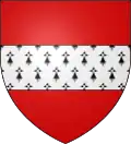
Heraldry
Arms of Tourmignies |
The arms of Tourmignies are blazoned : Gules, a fess ermine.
|
See also
References
- ↑ "Répertoire national des élus: les maires". data.gouv.fr, Plateforme ouverte des données publiques françaises (in French). 2 December 2020.
- ↑ "Populations légales 2021". The National Institute of Statistics and Economic Studies. 28 December 2023.
- ↑ INSEE commune file
- ↑ Population en historique depuis 1968, INSEE
Wikimedia Commons has media related to Tourmignies.
This article is issued from Wikipedia. The text is licensed under Creative Commons - Attribution - Sharealike. Additional terms may apply for the media files.