Laval-en-Belledonne | |
|---|---|
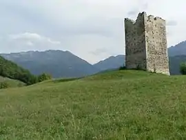 Tower of Montfallet | |
 Coat of arms | |
Location of Laval-en-Belledonne | |
 Laval-en-Belledonne 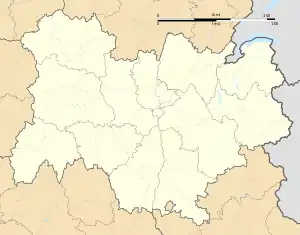 Laval-en-Belledonne | |
| Coordinates: 45°15′14″N 5°56′00″E / 45.2539°N 5.9333°E | |
| Country | France |
| Region | Auvergne-Rhône-Alpes |
| Department | Isère |
| Arrondissement | Grenoble |
| Canton | Le Moyen Grésivaudan |
| Intercommunality | CC Le Grésivaudan |
| Government | |
| • Mayor (2020–2026) | Mireille Degoul-Stissi[1] |
| Area 1 | 25.33 km2 (9.78 sq mi) |
| Population | 990 |
| • Density | 39/km2 (100/sq mi) |
| Time zone | UTC+01:00 (CET) |
| • Summer (DST) | UTC+02:00 (CEST) |
| INSEE/Postal code | 38206 /38190 |
| Elevation | 320–2,600 m (1,050–8,530 ft) (avg. 630 m or 2,070 ft) |
| 1 French Land Register data, which excludes lakes, ponds, glaciers > 1 km2 (0.386 sq mi or 247 acres) and river estuaries. | |
Laval-en-Belledonne (French pronunciation: [laval ɑ̃ bɛldɔn]; before 2020: Laval)[3] is a commune in the Isère department in southeastern France.
Population
| Year | Pop. | ±% p.a. |
|---|---|---|
| 1968 | 448 | — |
| 1975 | 450 | +0.06% |
| 1982 | 422 | −0.91% |
| 1990 | 525 | +2.77% |
| 1999 | 805 | +4.86% |
| 2009 | 956 | +1.73% |
| 2014 | 986 | +0.62% |
| 2020 | 989 | +0.05% |
| Source: INSEE[4] | ||
History

The Laval town hall and schools in 1908
See also
References
- ↑ "Répertoire national des élus: les maires". data.gouv.fr, Plateforme ouverte des données publiques françaises (in French). 9 August 2021.
- ↑ "Populations légales 2021". The National Institute of Statistics and Economic Studies. 28 December 2023.
- ↑ Décret n° 2020-175 26 February 2020 (in French)
- ↑ Population en historique depuis 1968, INSEE
Wikimedia Commons has media related to Laval-en-Belledonne.
This article is issued from Wikipedia. The text is licensed under Creative Commons - Attribution - Sharealike. Additional terms may apply for the media files.