Saint-Marcel-en-Murat | |
|---|---|
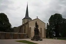 The church in Saint-Marcel-en-Murat | |
Location of Saint-Marcel-en-Murat | |
 Saint-Marcel-en-Murat 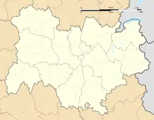 Saint-Marcel-en-Murat | |
| Coordinates: 46°19′18″N 3°00′33″E / 46.3217°N 3.0092°E | |
| Country | France |
| Region | Auvergne-Rhône-Alpes |
| Department | Allier |
| Arrondissement | Montluçon |
| Canton | Commentry |
| Intercommunality | Commentry Montmarault Néris Communauté |
| Government | |
| • Mayor (2020–2026) | Jean-Pierre Laurent[1] |
| Area 1 | 16.82 km2 (6.49 sq mi) |
| Population | 126 |
| • Density | 7.5/km2 (19/sq mi) |
| Time zone | UTC+01:00 (CET) |
| • Summer (DST) | UTC+02:00 (CEST) |
| INSEE/Postal code | 03243 /03390 |
| Elevation | 356–484 m (1,168–1,588 ft) |
| 1 French Land Register data, which excludes lakes, ponds, glaciers > 1 km2 (0.386 sq mi or 247 acres) and river estuaries. | |
Saint-Marcel-en-Murat is a commune in the Allier department in Auvergne-Rhône-Alpes in central France.[3]
Population
| Year | Pop. | ±% |
|---|---|---|
| 1962 | 203 | — |
| 1968 | 237 | +16.7% |
| 1975 | 188 | −20.7% |
| 1982 | 157 | −16.5% |
| 1990 | 179 | +14.0% |
| 1999 | 157 | −12.3% |
| 2008 | 132 | −15.9% |
| 2013 | 140 | +6.1% |
| Source: INSEE (1968–2013) | ||
See also
References
- ↑ "Répertoire national des élus: les maires". data.gouv.fr, Plateforme ouverte des données publiques françaises (in French). 2 December 2020.
- ↑ "Populations légales 2021". The National Institute of Statistics and Economic Studies. 28 December 2023.
- ↑ INSEE commune file
Wikimedia Commons has media related to Saint-Marcel-en-Murat.
This article is issued from Wikipedia. The text is licensed under Creative Commons - Attribution - Sharealike. Additional terms may apply for the media files.