Bellon | |
|---|---|
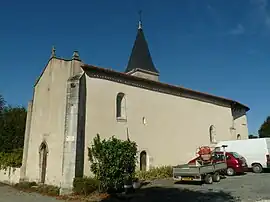 The church in Bellon | |
.svg.png.webp) Coat of arms | |
Location of Bellon | |
 Bellon 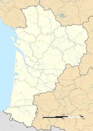 Bellon | |
| Coordinates: 45°18′13″N 0°07′13″E / 45.3036°N 0.1203°E | |
| Country | France |
| Region | Nouvelle-Aquitaine |
| Department | Charente |
| Arrondissement | Angoulême |
| Canton | Tude-et-Lavalette |
| Intercommunality | Lavalette Tude Dronne |
| Government | |
| • Mayor (2020–2026) | Philippe Vigier[1] |
| Area 1 | 9.13 km2 (3.53 sq mi) |
| Population | 137 |
| • Density | 15/km2 (39/sq mi) |
| Time zone | UTC+01:00 (CET) |
| • Summer (DST) | UTC+02:00 (CEST) |
| INSEE/Postal code | 16037 /16210 |
| Elevation | 53–124 m (174–407 ft) (avg. 80 m or 260 ft) |
| 1 French Land Register data, which excludes lakes, ponds, glaciers > 1 km2 (0.386 sq mi or 247 acres) and river estuaries. | |
Bellon (French pronunciation: [belɔ̃]) is a commune in the Charente department in southwestern France.
Population
| Year | Pop. | ±% p.a. |
|---|---|---|
| 1968 | 176 | — |
| 1975 | 157 | −1.62% |
| 1982 | 179 | +1.89% |
| 1990 | 156 | −1.70% |
| 1999 | 152 | −0.29% |
| 2009 | 167 | +0.95% |
| 2014 | 160 | −0.85% |
| 2020 | 140 | −2.20% |
| Source: INSEE[3] | ||
See also
References
- ↑ "Répertoire national des élus: les maires". data.gouv.fr, Plateforme ouverte des données publiques françaises (in French). 9 August 2021.
- ↑ "Populations légales 2021". The National Institute of Statistics and Economic Studies. 28 December 2023.
- ↑ Population en historique depuis 1968, INSEE
Wikimedia Commons has media related to Bellon (Charente).
This article is issued from Wikipedia. The text is licensed under Creative Commons - Attribution - Sharealike. Additional terms may apply for the media files.