Bermesnil | |
|---|---|
.JPG.webp) The church of Mesnil-Eudin | |
Location of Bermesnil | |
 Bermesnil 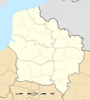 Bermesnil | |
| Coordinates: 49°53′57″N 1°44′09″E / 49.8992°N 1.7358°E | |
| Country | France |
| Region | Hauts-de-France |
| Department | Somme |
| Arrondissement | Amiens |
| Canton | Poix-de-Picardie |
| Intercommunality | CC Somme Sud-Ouest |
| Government | |
| • Mayor (2020–2026) | Roger Taverne[1] |
| Area 1 | 4.1 km2 (1.6 sq mi) |
| Population | 206 |
| • Density | 50/km2 (130/sq mi) |
| Time zone | UTC+01:00 (CET) |
| • Summer (DST) | UTC+02:00 (CEST) |
| INSEE/Postal code | 80084 /80140 |
| Elevation | 135–179 m (443–587 ft) (avg. 179 m or 587 ft) |
| 1 French Land Register data, which excludes lakes, ponds, glaciers > 1 km2 (0.386 sq mi or 247 acres) and river estuaries. | |
Bermesnil (French pronunciation: [bɛʁmenil]; Picard: Bérmini) is a commune in the Somme department in Hauts-de-France in northern France.
Geography
Bermesnil is situated on the D187 road, near the banks of the river Bresle, some 20 miles (32 km) southwest of Abbeville.
Population
| Year | Pop. | ±% p.a. |
|---|---|---|
| 1968 | 186 | — |
| 1975 | 182 | −0.31% |
| 1982 | 200 | +1.36% |
| 1990 | 214 | +0.85% |
| 1999 | 203 | −0.58% |
| 2007 | 249 | +2.59% |
| 2012 | 235 | −1.15% |
| 2017 | 222 | −1.13% |
| Source: INSEE[3] | ||
See also
References
- ↑ "Répertoire national des élus: les maires". data.gouv.fr, Plateforme ouverte des données publiques françaises (in French). 2 December 2020.
- ↑ "Populations légales 2021". The National Institute of Statistics and Economic Studies. 28 December 2023.
- ↑ Population en historique depuis 1968, INSEE
Wikimedia Commons has media related to Bermesnil.
This article is issued from Wikipedia. The text is licensed under Creative Commons - Attribution - Sharealike. Additional terms may apply for the media files.