Friaucourt | |
|---|---|
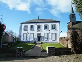 The town hall in Friaucourt | |
.svg.png.webp) Coat of arms | |
Location of Friaucourt | |
 Friaucourt 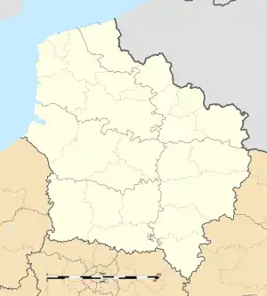 Friaucourt | |
| Coordinates: 50°05′24″N 1°28′36″E / 50.09°N 1.4767°E | |
| Country | France |
| Region | Hauts-de-France |
| Department | Somme |
| Arrondissement | Abbeville |
| Canton | Friville-Escarbotin |
| Intercommunality | CC Villes Sœurs |
| Government | |
| • Mayor (2020–2026) | Jean-Michel Delrue[1] |
| Area 1 | 4.16 km2 (1.61 sq mi) |
| Population | 688 |
| • Density | 170/km2 (430/sq mi) |
| Time zone | UTC+01:00 (CET) |
| • Summer (DST) | UTC+02:00 (CEST) |
| INSEE/Postal code | 80364 /80460 |
| Elevation | 70–114 m (230–374 ft) (avg. 80 m or 260 ft) |
| 1 French Land Register data, which excludes lakes, ponds, glaciers > 1 km2 (0.386 sq mi or 247 acres) and river estuaries. | |
Friaucourt (French pronunciation: [fʁijokuʁ]) is a commune in the Somme department in Hauts-de-France in northern France.
Geography
Friaucourt is situated a mile and a half from the coast, 16 miles (26 km) west of Abbeville on the D19 and D63 junction
Population
| Year | Pop. | ±% p.a. |
|---|---|---|
| 1968 | 605 | — |
| 1975 | 696 | +2.02% |
| 1982 | 761 | +1.28% |
| 1990 | 708 | −0.90% |
| 1999 | 669 | −0.63% |
| 2007 | 707 | +0.69% |
| 2012 | 763 | +1.54% |
| 2017 | 742 | −0.56% |
| Source: INSEE[3] | ||
See also
References
- ↑ "Répertoire national des élus: les maires". data.gouv.fr, Plateforme ouverte des données publiques françaises (in French). 2 December 2020.
- ↑ "Populations légales 2021". The National Institute of Statistics and Economic Studies. 28 December 2023.
- ↑ Population en historique depuis 1968, INSEE
Wikimedia Commons has media related to Friaucourt.
This article is issued from Wikipedia. The text is licensed under Creative Commons - Attribution - Sharealike. Additional terms may apply for the media files.