Farnay | |
|---|---|
 | |
Location of Farnay | |
 Farnay 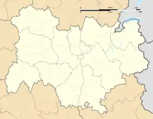 Farnay | |
| Coordinates: 45°29′39″N 4°35′55″E / 45.4942°N 4.5986°E | |
| Country | France |
| Region | Auvergne-Rhône-Alpes |
| Department | Loire |
| Arrondissement | Saint-Étienne |
| Canton | Rive-de-Gier |
| Intercommunality | Saint-Étienne Métropole |
| Government | |
| • Mayor (2020–2026) | Jean-Alain Barrier[1] |
| Area 1 | 7.93 km2 (3.06 sq mi) |
| Population | 1,360 |
| • Density | 170/km2 (440/sq mi) |
| Time zone | UTC+01:00 (CET) |
| • Summer (DST) | UTC+02:00 (CEST) |
| INSEE/Postal code | 42093 /42320 |
| Elevation | 315–792 m (1,033–2,598 ft) (avg. 445 m or 1,460 ft) |
| 1 French Land Register data, which excludes lakes, ponds, glaciers > 1 km2 (0.386 sq mi or 247 acres) and river estuaries. | |
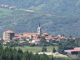
Farnay (French pronunciation: [faʁnɛ]) is a commune in the Loire department in central France.
Population
| Year | Pop. | ±% p.a. |
|---|---|---|
| 1968 | 305 | — |
| 1975 | 446 | +5.58% |
| 1982 | 879 | +10.18% |
| 1990 | 982 | +1.39% |
| 1999 | 1,139 | +1.66% |
| 2009 | 1,314 | +1.44% |
| 2014 | 1,396 | +1.22% |
| 2020 | 1,364 | −0.39% |
| Source: INSEE[3] | ||
See also
References
- ↑ "Répertoire national des élus: les maires". data.gouv.fr, Plateforme ouverte des données publiques françaises (in French). 2 December 2020.
- ↑ "Populations légales 2021". The National Institute of Statistics and Economic Studies. 28 December 2023.
- ↑ Population en historique depuis 1968, INSEE
Wikimedia Commons has media related to Farnay.
This article is issued from Wikipedia. The text is licensed under Creative Commons - Attribution - Sharealike. Additional terms may apply for the media files.